Canoeing

Painted Rocks State Park

Painted Rocks State Park

Painted Rocks State Park

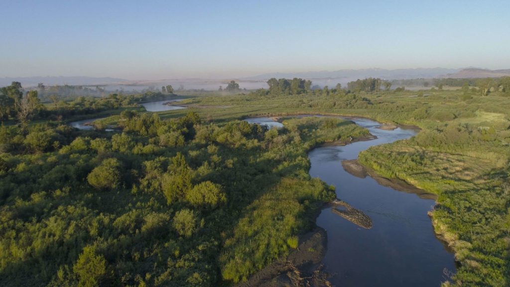
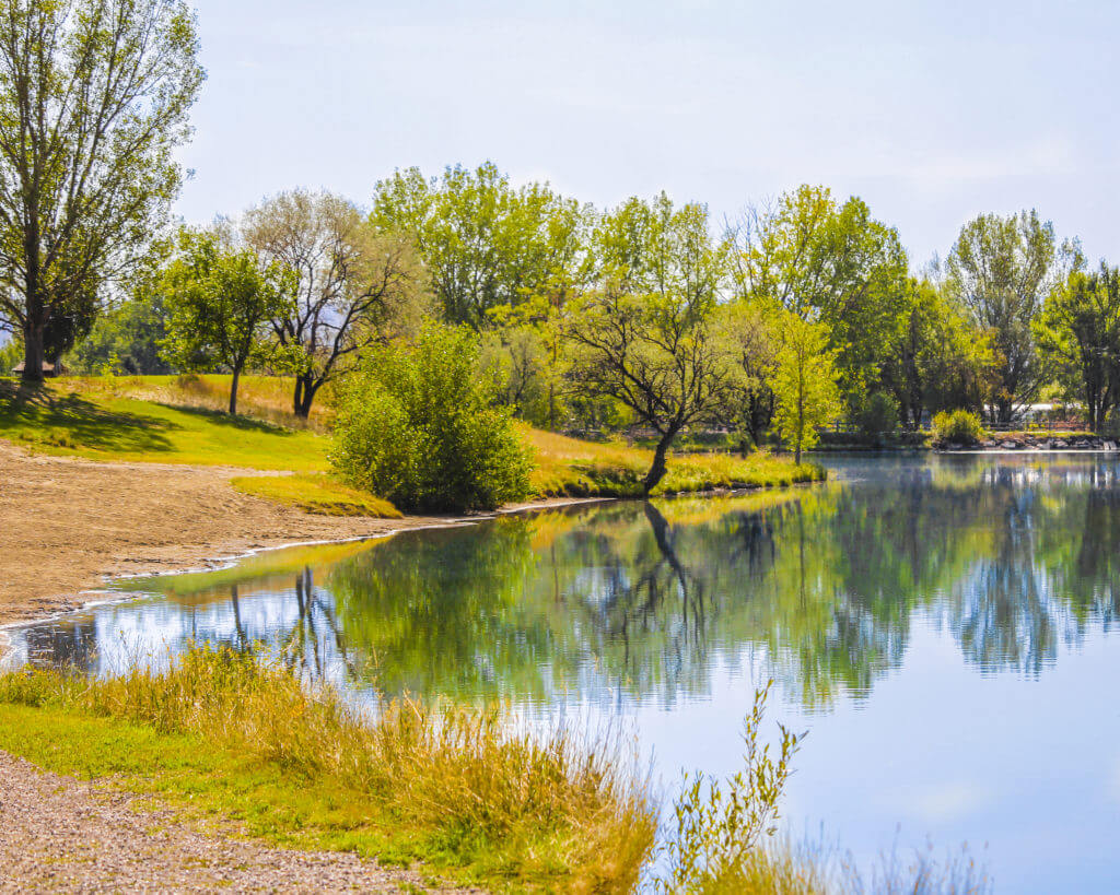
Named for the green, yellow and orange lichens that cover the grey and black walls of the granite and rhyolite cliffs, Painted Rocks State Park is located in the West Fork Valley of the Bitterroot Mountains.

We are able to bring you valuable information about this amazing state park thanks to the support of:

1
IMG_5965

Download Campsite Map

Looking to camp?

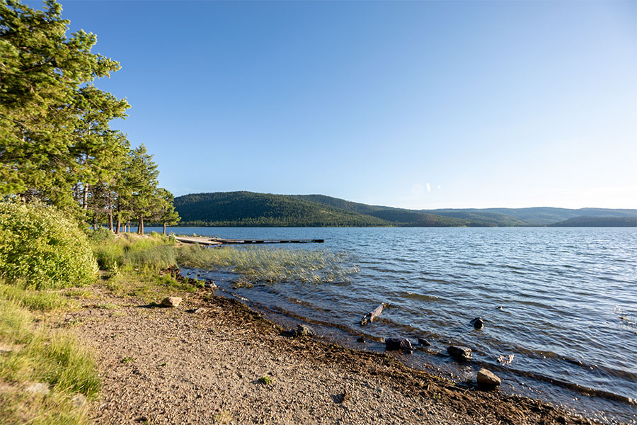
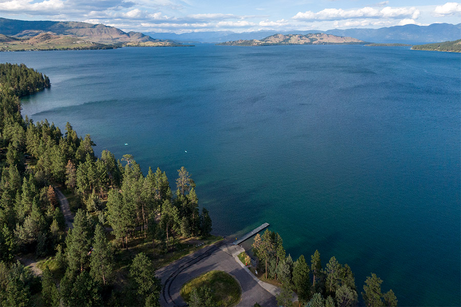
Painted Rocks State Park offers 25 campsites, a boat ramp and a boat dock. Be sure if you’re bringing your trailer or RV that it’s no longer than 25 feet!

And if you like to hike, there are many trailheads near the park that offer access to national forest land. 

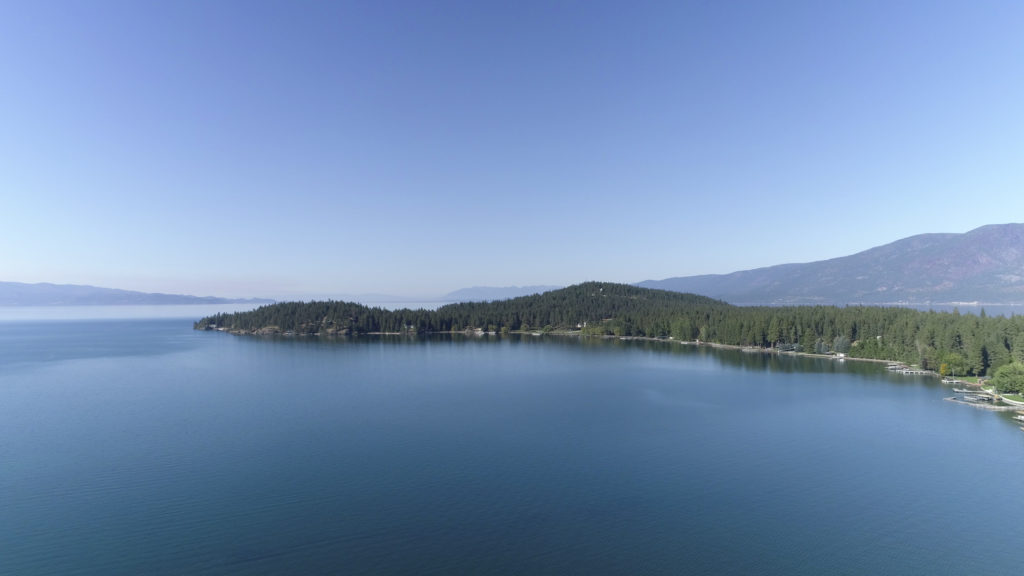
Painted Rocks Dam was originally planned to be constructed for agricultural use!

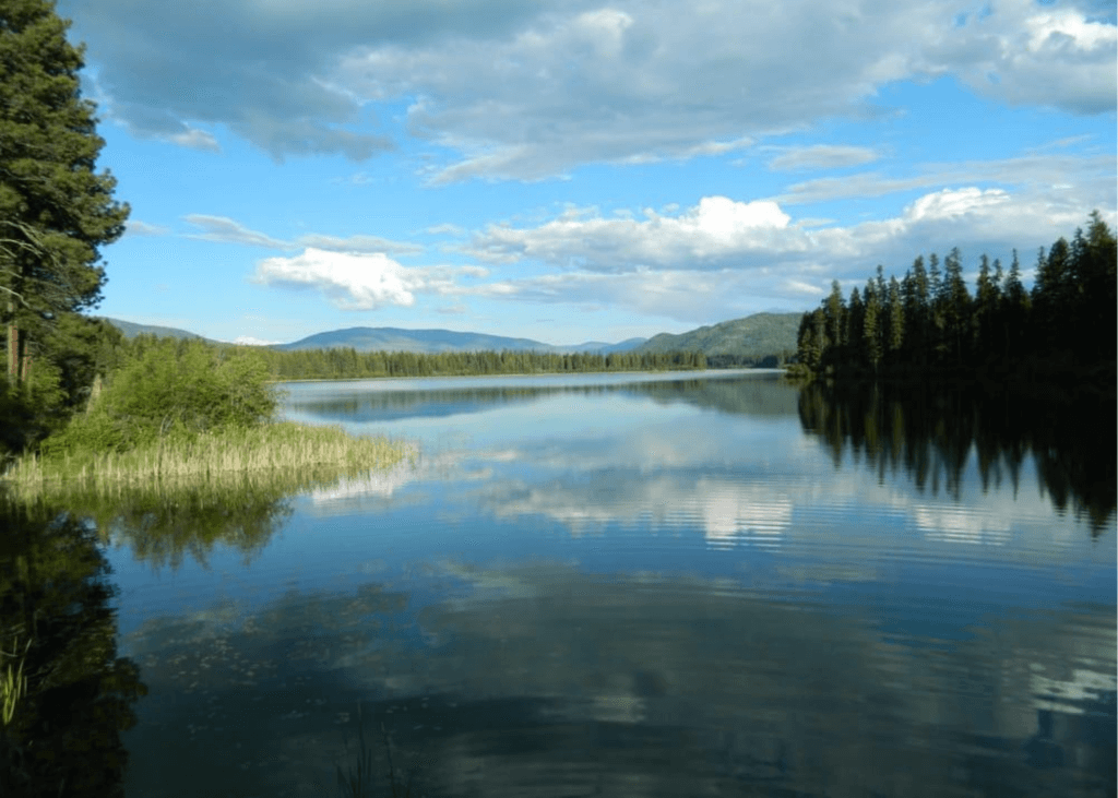
The Montana Water Conservation started work on Painted Rock Dam in 1939. Today, Painted Rocks Reservoir provides water for irrigation, stock water, domestic use and in-stream flows for fish. The reservoir the dam creates is the perfect location for boating or fishing!

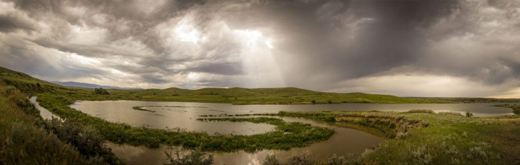
While in the park, keep your eyes open for the diverse populations of wildlife including elk, mule deer, white-tailed deer, black bear or moose! You may even catch a glimpse of bighorn sheep or peregrine falcons which were reintroduced to the area in the 1980s.

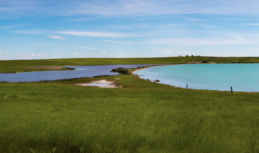
Are you or do you know an avid birdwatcher? If you happen to be in the area in the spring or fall, you’re in luck! Osprey, great blue heron, water ouzels, spotted sandpiper and kill-deer make pitstops in their migration patterns at Painted Rocks State Park.

Part of the homeland of the Salish people for many years, this area continues to be a place of great value to the Salish. The area did, and still does, provide great hunting and a place to gather traditional foods such as huckleberries, serviceberries, Bitterroot, trout, as well as other fish and mountain tea. 

Did You Know

Curious what other visitors have had to say about the park?

"It was beautiful! I've been here many times but this is the first time I kayaked it. Absolutely smooth as glass on the most perfect sunshiny day."

"Beautiful, peaceful, wonderful place to spend time with the family."

"What is not to love. So worth the drive."

"Lovely scenery, very peaceful. Saw my first big horn sheep in the wild here. It was amazing"


Quick Facts
  • pine icon

    Park

    Open Year-Round

    Dawn to Dusk

  • pine icon

    Location

    8809 West Fork Road Darby, MT 59829

Painted Rocks State Park Read More »

Missouri Headwaters State Park 2

Missouri Headwaters State Park

Missouri Headwaters State Park

Missouri Headwaters State Park

Missouri Headwaters State Park is just outside of Three Forks downtown and only 35 minutes outside of Bozeman. The convergence of the Jefferson, Madison, and Gallatin rivers is the start of the longest river in North America, the Missouri River.  Considered an essential part of the geography of the western U.S.

We are able to bring you valuable information about this amazing state park thanks to the support of:

Missouri Headwaters State Park
IMG_5965

Download Campsite Map

IMG_5966

Download Park Map

Things to do:

Just outside of Three Forks, you’ll find Missouri Headwaters State Park, the confluence of the Madison, Jefferson and Gallatin rivers which form the 2,300 mile Missouri River.

At Missouri Headwaters State Park, you can still find the area looking much as it did historically - with much of the region's abundant wildlife, vegetation, and scenic beauty preserved - making it clear what has attracted people for thousands of years.

  • Looking to camp in history? There are 17 campsites available and you can even rent a tipi!
  • Interpretive displays describing the area’s cultural and natural history can be found to help guide you!
  • Take your bike for a spin on the many trails throughout the park!
  • Not much of a biker? Use the trails for a scenic hike instead!
  • Take a float down the river, you’ll have your choice of three!
  • Visit Fort Rock to take a look at historic pictographs. 

The three rivers that converge to form the Missouri River are named for President Thomas Jefferson, Secretary of State James Madison and Treasury Secretary Albert Gallatin!

The rich, fertile soil along with the proximity to fresh water, brought the Flathead, Bannock and Shoshone Indians to the region and later trappers and settlers, and now this beautiful land has been preserved as a state park for visitors just like you. 

Known for an abundance of wildlife, Missouri Headwaters State Park is a great place to explore, but don’t forget your bug spray! 

In addition to its vast natural resources and outdoor activities, Missouri Headwaters State Park also boasts extensive cultural history - ranging from the tribes that lived there beginning 3,000 years ago to Lewis and Clark to fur traders to settlers.

In late July 1805, William Clark and a small number from the Corps of Discovery reached the Headwaters while scouting for Shoshone Indians, whom they hoped would sell them horses. It was Sacajawea, who recognized the area as where she was captured as a child by the Hidatsa, that led the expedition successfully there.

While at the confluence, Clark left a note for Meriwether Lewis to find and later, Lewis Rock was named for him.

Did You Know

Curious what other visitors have had to say about the park?

"Very interesting spot to see three rivers come together to make the start of the Missouri River."

"Great campground and great camp host! Paul is awesome and hilarious! He also recommended good fishing spots and filled us in on the local moose population, (phone pics included!) This area is spectacular for bird watching, fishing, hiking and taking in some informative L&C history. Restrooms were spotless and smelled nothing like a vault toilet. Even enjoyed a lightning storm on our last night to wrap it all up. Great entertainment! We’ll probably be back in the fall with our little retro trailer for more fishing, exploring and dry-camping."

"We made a spur of the moment trip with 5 other couples from the Bitterroot Valley . Arrived and were met by the campground host, who was not only a character, but had this park and facilities absolutely spit- shined! The "Dogs on leash" rule is strictly enforced, but makes for a more enjoyable stay for all. My two Labradors liked the Host and the camping. Highly recommend."

"Quiet evening to enjoy the view. Be sure and climb up Fort Rock and enjoy the vistas from a little higher up. Easy walk up."


Quick Facts
  • pine icon

    Park

    Open Year-Round

  • pine icon

    Campground

    Open Year-Round​

  • pine icon

    Location

    1585 Trident Road

    Three Forks, MT 5975

Missouri Headwaters State Park Read More »

logan-state-park

Logan State Park

Logan State Park

Logan State Park

Just off Highway 2 between Libby and Kalispell, you’ll find Logan State Park, a local hotspot. 

Logan State Park
IMG_5965

Download Campsite Map

Looking to camp?

Logan has 37 campsites but no tent-only sites. RVs and trailers are more than welcome as long as they are no longer than 40 feet. The RV dump station closes in early October.
You’ll even find a playset for the kids and a short nature trail here.

  • Take a dip in the lake and go swimming
  • Go for a boat ride and find some peace.
  • You and your friends or family can even play a game of horseshoes!
  • Take a chance and go water skiing!
  • More of a fisher? You’ll find loads of salmon, trout, perch, pike, and bass!
  • 17 Acres

Located in the middle of the 3,000-acre Thompson Chain of Lakes, Logan is heavily forested with Western Larch, Douglas-Fir, and Ponderosa Pine, making for a beautiful view of the tree-covered, mountainous area.

Did You Know

Curious what other visitors have had to say about the park?

"Very clean great price, camp host very friendly and knowledgeable about everything."

"We camp host here. The people are fantastic. The campground is clean,quiet and right on a beautiful lake with great fishing. All sites have electric. There is water, showers and dump station available on site. Boat slips are available and there is a paved boat launch ramp. There is a playground for the kids and a grassy beach area for swimming. Great place to camp."

"Great park highly recommended. The gate attendants are great and friendly also."

"We absolutely enjoyed our stay. The camp hosts and anyone who worked at the campground were stellar. They wanted you to enjoy your stay. Fishing excellent. Thank you. Only change I'd want is not paying for showers or if you did pay it not be limited to 6 minutes."


Quick Facts
  • pine icon

    Park

    Open Year-Round

    7 a.m. to 10 p.m.

  • pine icon

    Campground

    Open Year-Round

  • pine icon

    Water and shower

    Open

  • pine icon

    Boat Slips

    Available

  • pine icon

    Location

    77518 US HWY 2 Libby, MT 59923

Logan State Park Read More »

Lewis & Clark Caverns State Park 1

Lewis & Clark Caverns State Park

Lewis & Clark Caverns State Park

Lewis & Clark Caverns State Park

Located just east of Whitehall, MT, lies the Lewis and Clark Caverns. Discovered in 1892 by local hunters, these caverns went on to become Montana's first state park.

As one of the largest known limestone cavern systems in the northwest, Montanans have been exploring the caves for over 100 years!

Lewis & Clark Caverns State Park
IMG_5965

Download Campsite Map

IMG_5966

Download Park Map

Interested in tours?

Access to the cave is by guided tours only, May through September, with limited candlelight tours offered in December. Lewis & Clark Caverns State Park also features camping and a network of trails to hike or bike, a state-of-the-art visitor center, interpretive displays, a gift shop, food and beverage concessions, an amphitheater, and interpretive events presented during the summer months.

Looking to camp?

The park has a large campground with 40 campsites, a tipi, and three cabins, which you can reserve online, and a group camping area, which you must contact the park to reserve. There is a $5 charge to use the dump station.

The site encompasses 3,015 acres. The entry area is at an elevation of 4,300 feet and the caverns area is at an elevation of 5,300 feet.

Cave access is only available through the guided tour. You will be asked to please wear a mask. 

Cavern Tours are now being offered. 

The park offers two tours: The Classic Tour, which visits the majority of the developed cave but is physically challenging, and The Paradise tour, that will guide you to the largest, most decorated rooms of the cave. Tour length is approximately 1 mile and the tour takes about 1 1/2 hours.

The tours are first come, first served.

Tickets are limited.

Get in touch with the park for more information. 

Bring a face covering. Face coverings are required during cave tours.

Although optional for other areas of the park. Park disinfecting procedures involve using a bleach solution.

Visitors should consider wearing new or very clean gloves, especially in the caverns where the handrails are cleaned with a bleach solution every tour.

Because of group size restrictions, tours are very limited. Park facilities that are open now are disinfected intermittently. We suggest visitors bring hand sanitizer and/or disinfecting wipes for personal use.

Lewis & Clark Caverns State Park features one of the largest known limestone caverns in the Northwest.

Did You Know

Curious what other visitors have had to say about the park?

"The caverns are amazing and the tours are fantastic. I have been through several times over the years and always loved the experience. The candlelight tours in the winter are amazing for the experience and historic aspects, but the summer tours really show off the caverns with the lights. All of the guides are passionate about their jobs and the caves, and love to teach. Great place to visit and bring friends and family."

"Absolutely beautiful! The bats are very cool to see as well! Can't wait to see it again."

"These Caverns are a jewel. The drive to the caverns winds along the Jefferson River, with cliffs adorning the sides of the road. Our party were excited to to the Caverns today, as it was the rare tour through the cave system with candles!!! This Candlelight tour is offered only at Christmas. What a treat!! The vision of the fellow participants weaving among the cave features is idyllic. It is surprising how much light the candlelight can make in the total dark. This is a best kept secret. The tour guides are top notch."

"A truly fascinating and unique experience! Amazing formations of nature. A true treasure. Outstanding tour and educational experience. Highly recommend!"


Quick Facts
  • pine icon

    Park

    Open Year-Round

  • pine icon

    Visitor Center

    May through September: 9 a.m. - 4:30 p.m. daily

    October through April: 10 a.m. - 4 p.m. daily

  • pine icon

    Water

    Available May through September as weather allows

  • pine icon

    Showers & Comfort Station

    Open through September as weather allows

  • pine icon

    Montana Gift Corral

    8:30 a.m. - 5 p.m. Wednesday through Monday

  • pine icon

    Location

    25 Lewis and Clark Caverns Rd. Whitehall, MT 59759

Lewis & Clark Caverns State Park Read More »

Lake Mary Ronan State Park

Lake Mary Ronan State Park

Lake Mary Ronan State Park

Lake Mary Ronan State Park is just seven miles west of Flathead Lake.

This park offers a quiet camping opportunity nestled among a boreal forest.

This state park is noted for its fishing and numerous trails that lead into the surrounding areas, which abound in wildflowers and wildlife.

Lake Mary Ronan State Park
IMG_5965

Download Campsite Map

IMG_5966

Download Park Map

IMG_5970

Watch Park Videos

Looking to camp?

Lake Mary Ronan State Park's campground offers 25 campsites, including seasonal electricity at individual campsites, a paved campground road and spurs, plus a new and improved group camping area, boat trailer parking and a boating ramp.
This state park is on 120 acres at an elevation of 3,770 ft.

Off the beaten path just 7 miles west of Flathead Lake, this park is shaded by Douglas fir and western larch.
Lake Mary Ronan provides a quiet opportunity for relaxing, camping, and fishing from either a boat or the parks boat dock. A hiking trail leads into the surrounding area which abound with wildflowers and wildlife.

Several businesses near the park offer a variety of services including food, beverages, bait, and more.

Did You Know

Curious what other visitors have had to say about the park?

"One of my families favorite places to camp. Fishing is great and the campground is quiet"

"Beautiful lodge ,great amenities, extremely lovely and helpful staff. Very excited to come back for a longer stay!"

"Stopped to check out the state campground and lake, very beautiful and peaceful. Dennis, park host, very friendly and knowledgeable of the lake, fishing and surrounding areas. My husband and I are looking forward to camping there."

"Beautiful location. Friendly hosts. Always kept clean and tidy."


Quick Facts
  • pine icon

    Park

    Open

  • pine icon

    Campground 

    Open until late November

  • pine icon

    Electricity

    Available through October

  • pine icon

    Potable water

    Available May through September

  • pine icon

    Dock

    Available during open water

  • pine icon

    Location

    50623 Lake Mary Ronan Rd. Dayton, MT 59860

Parks That Others Are Visiting

Lake Mary Ronan State Park Read More »

Lake Elmo State Park

Lake Elmo State Park

Lake Elmo State Park

Inside the city limits of Billings is Lake Elmo State Park. A large 64-acre reservoir, Lake Elmo is the perfect place to swim, paddle, fish, picnic, bird watch, or hike the 1.4-mile nature trail.  The Lake, originally known as Holling Lake Reservoir, was constructed to provide water to irrigated farmland as part of the Carey Land Act of 1894.  The water that fills the man-made lake is diverted from the Yellowstone River near Laurel, MT, and flows through 63 miles of gravity-fed canals before reaching the lake.

We are able to bring you valuable information about this amazing state park thanks to the support of:

Lake Elmo State Park
IMG_5965

Download Trail Map

IMG_5966

Download Park Map

Things to do:

Prior to becoming a State Park in 1983, Lake Elmo was once the site of a two-story restaurant and night club known for dancing, big band music, and two-inch thick T-bone steaks.  Nearby property owners created beaches for swimming and even cleared snow from the lake in the winter to host ice skating.  At once point a thriving boat club was formed by local water skiing and motor boating enthusiasts.

The Regional Office for Montana Fish, Wildlife, and Parks is now located in the park.  The Regional Office houses an impressive collection of taxidermied birds, fish, and wildlife.  You can also purchase conservation licenses and apply for permits at the office which is open weekdays from 8 a.m. to 5 p.m.

A special feature of Lake Elmo is its Dog Park. The 200-square-foot fenced-in area includes a water area and is located on the west side of the lake. Each visitor is allowed a maximum of two dogs in this special area. Dogs must be 4 months or older. Dogs must be on a leash in all other areas of Lake Elmo State Park.

In the 1930s and 1940s, the Lake Elmo Supper Club drew people for dining, dancing, and watching water skiers just out the back door. The Supper Club burned down in 1946, but Lake Elmo continues to be a popular place today.

The reservoir was constructed in 1906 and serves as the storage basin for the Billings Bench Water Association. 

Your four-legged friends will love Lake Elmo State Park as much as you! The dog park at Lake Elmo is a 200-square-foot fenced area that includes access to the water located on the west side of the lake. You and two of your furry friends are allowed to run off-leash in this area, but must be on a leash in all other parts of the park. 

During the summer, the lake is stocked with fish regularly and Roger’s Pier is an excellent fishing spot on the south shore of the lake. And although a popular place to cool off in the summer, the lake can be accessed from many points which means these parks never feel too overcrowded. 

Only non-motorized boating is allowed on the lake though, so you won’t find any water skiing here like you could in the 30s and 40s!

Did You Know

Curious what other visitors have had to say about the park?

"It's basically on the outskirts of town. Fair sized, man made lake with stocked, variety of fish. No motorized craft allowed on the lake. There are picnic shelters, kids play ground, paved parking and restrooms. The water's edge is a work in progress with some beach areas and a boat ramp. No overnight camping. A great day trip."

"I really like this lake, not only is it large enough to explore it has great picknick areas, walking trails. It's very clean and well taken care of."

"Great family place. Canoeing, swimming, and just fun in the sun with people you care about."

"A beautiful lake right in town and watching the sunset there was breathtaking."


Quick Facts
  • pine icon

    Park

    Day Use Only - no camping
    Open daily all year
    5am - 10pm

  • pine icon

    Location

    2300 Lake Elmo Drive Billings, MT 59105

Parks That Others Are Visiting

Lake Elmo State Park Read More »

Finley Point State Park 1

Finley Point State Park

Finley Point State Park

Finley Point State Park

Located on a narrow point on the south side of Flathead Lake, Finley Point is an ideal park for boaters and RV campers.

Finley Point is one of Montana's oldest state parks and has been open to the public since July 12th, 1965. The park is known as an excellent fishing location for Lake Trout and Kokanee Salmon. Anglers should note that state and tribal fishing licenses are required for fishing in the area.

Finley Point State Park
IMG_5965

Download Campsite Map

Looking to boat?

Boaters can rent a slip in the marina, some of which offer electric and water hookups for those camping on their boats. Along with the camping slips, the marina also offers 12 boat slips without electricity.

Camping, boating, and other visitor facilities at Finley Point State Park were recently rebuilt or expanded by WGM Group of Missoula, MT.

The new park layout and expanded facilities allow for more visitors to enjoy the park without feeling crowded and reducing impacts on sensitive lakeshore habitat.

Thinking of camping? Finley Point offers 18 RV campsites, seven tent sites and four boat camping slips. Maximum RV length will vary by campsite, so be sure to check out the ReserveAmerica website for additional details. 

MT State Parks Rangers frequently host interpretive storytelling and other special events at the park.  These programs usually take place in the evening and are free to registered campers at the park.  

While in close proximity to Polson and very busy during the summer months, Finley Point’s mature conifer forest helps the campground feel secluded. 

Did You Know

Curious what other visitors have had to say about the park?

"One simple word “AMAZING!” We love Finely Point!!"

"Beautiful scenic area, even if it's for a quick stop on your road trip. There was also an amazing massive field of pinkish flowers just on the north end of it when we were there!"

"The site was amazing!! It had amazing views right on the shore."

"Nice sites and many close to the water. Trees, nice base for tents. Dogs ok"


Quick Facts
  • pine icon

    Park

    Open April through October

  • pine icon

    Campground

    Open April through October

  • Tree icon

    Dock

    Contact park for availability.
    Dock is unusable when lake level is low. Typically lake level is high enough mid-June through early-September.

    For waves & wind forecast, check NOAA Graphical Flathead Lake Forecast

  • pine icon

    Location

    31453 S. Finley Point Rd. Finley Pt., MT 59806

Finley Point State Park Read More »

Cooney State Park

Cooney State Park

Cooney State Park

Head to Cooney State Park, a reservoir 40 minutes south of Billings, to go boating, play in the water, camp, and fish. This is the most popular recreation area serving south-central Montana, and it's always a busy place in the summer!

We are able to bring you valuable information about this amazing state park thanks to the support of:

Visit Billings
Yellowstone Country Logo
Cooney State Park
IMG_5965

Download Campsite Map

IMG_5966

Download Park Map

Looking to fish?

Cooney has been a state park since October of 1970, and new visitor amenities have been added slowly over time. The 97 ft tall earthen dam on Red Lodge Creek that forms the reservoir was constructed in 1937 as part of a larger irrigation project for nearby farmers and ranchers.

Not only does the park have a gorgeous reservoir, but it has great views of the Beartooth Mountain Range in the background.

Regardless of the season, you’ll find excellent fishing for walleye and rainbow trout. And don’t forget, the Red Lodge Arm has a fish cleaning station!

Planning to bring your boat along? You shouldn’t have any issues finding a place to drop in with three boat docks and ramps surrounding the lake!

During the winter, some people enjoy kite-skiing across the lake! 

Camping is plentiful at Cooney State Park, with five campgrounds and 82 campsites, 19 of which have electricity! While the electricity in the campgrounds is on year-round, be aware the water is shut off during the winter months. 

There are also three day-use group areas available around the lake. 

Did You Know

Curious what other visitors have had to say about the park?

"Moon coming out on a beautiful night on Cooney, fireworks northeast, south Red Lodge mountain still snow on the runs, people laughing in the distance having fun, winds died so this sailboat not going anywhere, on the hook south of Red lodge camping area wow it really doesn't get any better than this!"

"Park Ranger and the camp host were both really great with answering all our questions and giving directions to camp and nearest local convenience store! The campground is clean and beautiful, right on the lake, but not much shade so come prepared!"

"Every day of fishing is a good day. Mostly with scenery like this."

"It's an awesome place! Boat ramps, fishing, boating swimming, fires and camping! And you can rent kayaks and paddle boards."


"Just a little piece of heaven."

Quick Facts
  • pine icon

    Park

    Open Year-Round

  • pine icon

    Electricity

    Available

  • pine icon

    Drinking Water

    Available May 15 - September 27.

  • pine icon

    Comfort Stations & Showers

    Flush toilets available May 15 - September 27.

    Metered showers available to all registered campers in Marshall Cove Campground.  Requires 8 quarters for each shower.

  • pine icon

    Docks

    Available May 1 - November 1, weather dependent

  • pine icon

    Location

    86 Lake Shore Road

    Roberts, MT 59070

Cooney State Park Read More »

Brush Lake State Park

Brush Lake State Park

Brush Lake State Park

Brush Lake State Park

Brush Lake State Park is the only state park in the northeast corner of Montana.

Brush Lake is a deep lake (65 feet) in a closed basin and the site of National Science Foundation research on climate change. The lake boasts 45 feet of sediments showcasing 10,000 years of pollen and mineral depositing helping to tell the story of climate, and its changes, since the Ice Age.

Brush Lake State Park
IMG_5965

Download Campsite Map

IMG_5966

Download Park Map

Looking to camp?

Brush Lake State Park is 280-acres and its water quality is theorized to be more ocean-like than freshwater like - making it an ideal swimming location in the summer months. Both deep and incredibly clear, Brush Lake’s beaches are surrounded by grass fields and spring wheat during the summer.

  • Hoping to camp? You can do so in one of the 12 campsites!
  • Take a hike and go bird watching along the shore.
  • Public swimming access is on the northeast part of the lake where the day-use area is also located.
  • Utilize the boat launch and take your boat, canoe or kayak out for a day on the water.
  • Have a picnic on the beach!
  • Plus so much more!

Due to its close proximity to Canada, during Prohibition liquor was easy to come by and kept the Brush Lake Summer Resort in business. There was also a dance hall! After the Prohibition era, church and scout groups used the lake, but in the years before it became a state park, Brush Lake wasn’t the popular destination it once had been. Today the area where the dance hall once stood on the south side of the lake, is now privately held.

In Eastern Montana, it is not uncommon to see the Aurora Borealis during solar events, especially during the fall and winter. Brush Lake's northern latitude and remote location make it a "stellar" destination for your next stargazing or northern lights viewing adventure. As a dark sky location, Brush Lake is guaranteed to bring some of the best night sky views in the area.

Because of the high alkali content, Brush Lake does not support a significant fish population. But in contrast, it showcases a distinctive aquamarine blue color. The lake attracts many varieties of birds including various species of ducks, gulls, and many others. Brush Lake has become a great location for bird watchers worldwide.

Did You Know

Curious what other visitors have had to say about the park?

"Just on weekdays enjoy the beauty of this lake! I liked when you reach there no network service so really enjoy your time , clean water nice for swimming and have fun with kids."

"Lake was nice and clean."

Quick Facts
  • pine icon

    Park

    Open May 1 - January 1 depending on snowfall
    Day use hours: 7 am to 10 pm.

  • pine icon

    Campground

    Open May 1 - January 1 depending on snowfall

  • pine icon

    Potable water

    Yes - depending on the weather

  • pine icon

    Location

    1733 Brush Lake Road
    Dagmar, MT 59219

Brush Lake State Park Read More »

Big Arm State Park

Big Arm State Park

Big Arm State Park

Big Arm State Park is located on the western shore of Flathead Lake and less than 20 minutes outside of Polson, MT.

Flathead is the largest natural freshwater lake in the western United States. Twenty-eight miles long and 15 miles wide, Flathead Lake is renowned for its beauty.


Big Arm State Park
IMG_5965

Download Campsite Map

IMG_5966

Download Park Map

Looking to camp?

The park has both flush and vault toilets, tent/RV sites, bear-resistant storage lockers, boat trailer parking, sheltered picnic tables, drinking water, grills/fire rings, firewood, picnic tables, trash cans, and coin-operated showers. RV/trailer size is limited to 30 feet in the 41 site campground. 

There are also seven tent-only campsites available. Big Arm has also added two yurts, including one that is entirely ADA accessible. Plans for more yurts, cabins and other accommodations are in the works. 

You will need a joint state/tribal for fishing license or fishing at this park, and campers may stay only 14 days during a 30-day period. Pets are required to be on leashes. Fees are charged for day use and camping.

  • Lounge on the long pebble beach or take a dip in the lake to cool off.
  • Come prepared with your joint state/tribal fishing license if you want to try and catch a big one!
  • Take a scenic hike on the trail, which provides outstanding views of the mountains.
  • Catch a glimpse of wildlife, including birds, deer, and even a bear from time to time
  • Spend a day on the lake boating, skiing or wakeboarding
  • Experience a feeling of tranquility while camping under a collection of mature ponderosa pine and juniper trees
  • Plus so many more!
  • Open April through October
  • Day-Use Area Open Year-Round
  • 217 acres
  • ADA Accessible 
  • Pets Allowed
  • Toilets (Vault & Flush)
  • Water
  • Yurt 
  • Firewood for Sale 
  • Picnic Shelter
  • Boat Launch

On Flathead Lake's Big Arm Bay, this park is a popular destination for camping, swimming, fishing, picnicking, and as a jump-off point to Wild Horse Island.

Big Arm's pebble beach is a popular place to get your feet wet or take a swim in the lake.

Mature pine and fir trees surround the campsites at the park. Other activities at the park include fishing for lake trout, boating, fishing, swimming, camping, picnicking, bicycling, hiking the park trails, wildlife viewing, scuba diving, and water-skiing.

The water in Ackley Lake comes from the Judith River and is stockpiled for irrigation use!

Did You Know

Curious what other visitors have had to say about the park?

"Wonderful camp grounds. Nice hosts, clean restrooms - overall well run and managed. It's a fantastic place to camp and play on the lake."

"Camped here with our boat. It was perfect! Great roomy sites and lots of shade. Yurt was very clean and bathrooms were better than most campsites we've been too."

"Big Arm campsite is super nice for fishing and swimming. Would 100% recommend it!"

"Beautiful place. Clear lake. Friendly people"


Quick Facts
  • pine icon

    Park

    Day use area open year-round

  • pine icon

    Campground

    Open April through October

  • pine icon

    Water

    Available mid-May through mid-September

  • pine icon

    Shower House & Flush Toilets

    Open mid-May through mid-September

  • pine icon

    Dock

    Normally available mid-March through November, weather permitting. 

  • pine icon

    Location

    28031 Big Arm State Park Road

    Big Arm, MT 59910

Parks That Others Are Visiting

Big Arm State Park Read More »

Skip to content