Parking

Tower Rock State Park

Tower Rock State Park

Tower Rock State Park

Tower Rock, a 424-foot high rock formation that marks the entrance to the Missouri River Canyon in the Adel Mountains Volcanic Field.

Tower Rock State Park
IMG_5965

Download Campsite Map

IMG_5966

Download Park Map

Want to learn more about the park?

Visitors can learn about geology and history through five interpretive panels located at the trailhead. The trail to the base of the saddle is maintained for a quarter-mile and if you plan to hike this short trail, be sure to keep your eyes open and listen for rattlesnakes!

This day use only park was once used by Native American tribes to mark the entrance to and exit of the buffalo hunting grounds in north central Montana.

Did You Know

Curious what other visitors have had to say about the park?

"The maintained portion of the trail was fabulous. If you go further be sure you have a map from all trails. We couldn't quite figure out the summit, but we had a lovely time. The views are incredible and my 8 and 10 year olds loved it. The pup was exhausted, but he did well, too. Perfect hike near the Missouri River!"

"Great scenery, excellent place for a small hike."

"It is majestic. Volcanic origins. I found seashells when I sat down on the trail and touched the dirt I was sitting on. Makes you think."

"Love hiking Tower Rock. Beautiful scenery!"


Quick Facts
  • pine icon

    Park

    Open Year-Round

  • pine icon

    Location

    2325 Old US HWY 91 Cascade, MT 59421

Tower Rock State Park Read More »

Tongue River Reservoir State Park

Tongue River Reservoir State Park

Tongue River Reservoir State Park

Tongue River Reservoir State Park is located near the southeastern border of Montana, just 10 minutes outside of Decker.

A 265-mile-long tributary of the Yellowstone River, “the Tongue” (as it is called locally) starts in Wyoming and runs through Montana.

The park features a 12-mile long reservoir set in the scenic prairie and bluff lands of southeastern Montana, which is characterized by the striking contrast of red shale and juniper canyons. Due to the rareness of large bodies of water like this in this part of the state, the park can see up to 50,000 visitors a year.

We are able to bring you valuable information about this amazing state park thanks to the support of:

Tongue River Reservoir State Park
IMG_5965

Download Campsite Map

Looking to camp?

81 reservable campsites with electric hookups, and 27 of those are double occupancy with two electric hook-ups. There are also 80 non-reservable, non-electric sites!

At 12 miles long, the reservoir makes for excellent fishing any time of year! You’ll find crappie, walleye, bass, and northern pike here. You can also fly fish below the dam, and a fish cleaning station is located within the park.

Forgot anything or just need additional supplies? The marina at Campers Point has firewood, ice, fishing and boating supplies, boat rentals, boat and RV storage, bait, groceries, snacks, drinks, gasoline, souvenirs, fishing and hunting licenses, and non-resident park passes.

While summertime may be the most popular time to visit the park, Tongue River Reservoir State Park also features amazing ice fishing and year-round campsites that support just that.

  • Take the boat out on the water! There are two boat ramps with docks, one at Campers Point and one at Pee Wee North.
  • Go for a swim! Sand Point has a small beach area for swimming.
  • Keep your eyes open for wildlife! You may see osprey, blue herons, deer, antelope, or bald eagles.
  • Bring your picnic! The designated day-use area has picnic tables at Campers Point and Sand Point.

Tongue River Reservoir has some of the best ice fishing in Montana.

Just ask Chris Jairell of Sheridan, WY who landed a massive 42-inch, 15-pound Tiger Muskie while ice fishing last year.

Tongue River Reservoir boasts miles and miles of ice to test your skill and get you out this winter.

You can also check The Marina's Facebook page to keep tabs on the water and weather conditions. They post regular updates as well as provide an opportunity to share your big fish stories. Just be prepared to provide photographic evidence when you do.

The Marina is also a great place to learn about what you can fish for, ice conditions, and travel tips. You can also call them at (406) 757-2225

Tongue River Reservoir State Park currently holds two state records for the weight of fish caught, including a 37.5 pound Northern Pike?

Did You Know

Curious what other visitors have had to say about the park?

"My most favorite places to go camping and fishing."

"Catch Walleye, Pike, Crappie, Bass, Cats, and MORE!"

"Great place to recreate with shore-side camping, most with electrical hookups available."

"Tongue River Reservoir has the best fishing - they have a wide variety of fish to choose from when They hit they hit you hard. Everything from walleye to catfish to a bluegill sunfish, bass, pike, crappie etc."


Quick Facts
  • pine icon

    Park

    Open Year-Round

  • pine icon

    Campground

    Open Year-Round

    Electricity available at some campgrounds
    Group areas & playground are open

  • pine icon

    Water & Fish Cleaning Stations

    Closed for the season.

    Electricity available at some campgrounds
    Group areas & playground are open

  • pine icon

    Location

    290 Campers Point Decker, MT 59025

Tongue River Reservoir State Park Read More »

Missouri Headwaters State Park 2

Missouri Headwaters State Park

Missouri Headwaters State Park

Missouri Headwaters State Park

Missouri Headwaters State Park is just outside of Three Forks downtown and only 35 minutes outside of Bozeman. The convergence of the Jefferson, Madison, and Gallatin rivers is the start of the longest river in North America, the Missouri River.  Considered an essential part of the geography of the western U.S.

We are able to bring you valuable information about this amazing state park thanks to the support of:

Missouri Headwaters State Park
IMG_5965

Download Campsite Map

IMG_5966

Download Park Map

Things to do:

Just outside of Three Forks, you’ll find Missouri Headwaters State Park, the confluence of the Madison, Jefferson and Gallatin rivers which form the 2,300 mile Missouri River.

At Missouri Headwaters State Park, you can still find the area looking much as it did historically - with much of the region's abundant wildlife, vegetation, and scenic beauty preserved - making it clear what has attracted people for thousands of years.

  • Looking to camp in history? There are 17 campsites available and you can even rent a tipi!
  • Interpretive displays describing the area’s cultural and natural history can be found to help guide you!
  • Take your bike for a spin on the many trails throughout the park!
  • Not much of a biker? Use the trails for a scenic hike instead!
  • Take a float down the river, you’ll have your choice of three!
  • Visit Fort Rock to take a look at historic pictographs. 

The three rivers that converge to form the Missouri River are named for President Thomas Jefferson, Secretary of State James Madison and Treasury Secretary Albert Gallatin!

The rich, fertile soil along with the proximity to fresh water, brought the Flathead, Bannock and Shoshone Indians to the region and later trappers and settlers, and now this beautiful land has been preserved as a state park for visitors just like you. 

Known for an abundance of wildlife, Missouri Headwaters State Park is a great place to explore, but don’t forget your bug spray! 

In addition to its vast natural resources and outdoor activities, Missouri Headwaters State Park also boasts extensive cultural history - ranging from the tribes that lived there beginning 3,000 years ago to Lewis and Clark to fur traders to settlers.

In late July 1805, William Clark and a small number from the Corps of Discovery reached the Headwaters while scouting for Shoshone Indians, whom they hoped would sell them horses. It was Sacajawea, who recognized the area as where she was captured as a child by the Hidatsa, that led the expedition successfully there.

While at the confluence, Clark left a note for Meriwether Lewis to find and later, Lewis Rock was named for him.

Did You Know

Curious what other visitors have had to say about the park?

"Very interesting spot to see three rivers come together to make the start of the Missouri River."

"Great campground and great camp host! Paul is awesome and hilarious! He also recommended good fishing spots and filled us in on the local moose population, (phone pics included!) This area is spectacular for bird watching, fishing, hiking and taking in some informative L&C history. Restrooms were spotless and smelled nothing like a vault toilet. Even enjoyed a lightning storm on our last night to wrap it all up. Great entertainment! We’ll probably be back in the fall with our little retro trailer for more fishing, exploring and dry-camping."

"We made a spur of the moment trip with 5 other couples from the Bitterroot Valley . Arrived and were met by the campground host, who was not only a character, but had this park and facilities absolutely spit- shined! The "Dogs on leash" rule is strictly enforced, but makes for a more enjoyable stay for all. My two Labradors liked the Host and the camping. Highly recommend."

"Quiet evening to enjoy the view. Be sure and climb up Fort Rock and enjoy the vistas from a little higher up. Easy walk up."


Quick Facts
  • pine icon

    Park

    Open Year-Round

  • pine icon

    Campground

    Open Year-Round​

  • pine icon

    Location

    1585 Trident Road

    Three Forks, MT 5975

Missouri Headwaters State Park Read More »

Milltown State Park 3

Milltown State Park

Milltown State Park

Milltown State Park

On the outskirts of Missoula you’ll find Montana’s newest state park Milltown State Park. Once a Superfund river restoration project, years of hard work from multiple state and federal agencies, non-profits, businesses, and committed volunteers helped make the park what it is today.

We are able to bring you valuable information about this amazing state park thanks to the support of:

Milltown State Park
IMG_5966

Download Park Map

Interpretive displays are placed both at the overlook and confluence areas to provide insight into the history of the area. The story of how people have used the park and the confluence of the Blackfoot and Clark Fork Rivers is told from multiple perspectives in these detailed and interesting displays.

Outdoor opportunities and cultural heritage merge at the restored confluence of the Clark Fork and Blackfoot Rivers at Milltown, providing a unique opportunity for visitors.


The park includes 500 acres of terrain that ranges from restored river bottoms to a pine-forested bluff that overlooks the confluence.

The park affords visitors a place to go hiking, biking, fishing, floating, and watching for birds and wildlife. The Milltown State Park Overlook is open and features interpretive displays and picnic tables. There are nearly three miles of hiking trails that lead from the Overlook down to the Clark Fork River and its floodplain trails. 

The Confluence and Gateway areas, on the north side of the river, saw construction begin in the summer of 2017. The park development include trails, an interpretive plaza, and river access. The grand opening for the Confluence area was June 23, 2018

Among the many stories from the deep past are the Glacial Lake Missoula floods that shaped the landscape thousands of years ago. The Salish and Kalispell know the confluence as the place of bull trout and consider it part of their ancestral home. In 19th century history, Meriwether Lewis made a Fourth of July passage through the confluence and decades later, the Mullan Expedition spent a harsh winter there. Beginning in the 1880s, the rivers were dammed to produce power for the mills and communities but at great consequence.

The hopeful story of the Milltown Dam removal and rivers' return offers an opportunity to explore America's changing relationship to the land as well as the benefits that river restoration yields for Montana's families and communities.

Did You Know

Curious what other visitors have had to say about the park?

"Super pretty day with blue skies. Easy walks for kids and grandparents."

"The State really did a beautiful job on this park it is awe inspiring and a photo in any direction of incredible landscaping."

"Good view, pretty wildflowers, walking trail, picnic table, quiet"

"Great place to relax"


Quick Facts
  • pine icon

    Park

    Open all year. Day Use only. No Camping.

  • pine icon

    Confluence Area gate hours

    October 16 through April 30:  9:00 a.m. – 5:00 pm.

    May 1 through August 31: 9:00 a.m. – 9:00 p.m.

    September 1 through October 15: 9:00 a.m. – 7 p.m.

  • pine icon

    Gateway & Overlook Area hours

    Sunrise to sunset.

  • pine icon

    Location

    Confluence Area

    7363 Juniper Drive

    Missoula, MT 

    Overlook Area

    1353 Deer Creek Road

    Missoula, MT

Milltown State Park Read More »

Makoshika

Makoshika State Park

Makoshika State Park

Makoshika State Park

Makoshika State Park features spectacular badland formations and the remains of the infamous Tyrannosaurus Rex, as well as other amazing dino fossils.

We are able to bring you valuable information about this amazing state park thanks to the support of:

Visit Southeast Montana
Makoshika State Park
IMG_5965

Download Campsite Map

IMG_5966

Download Park Map

Looking to dig for fossils?

The park offers special events throughout the year, including Montana Shakespeare in the Park, Friday night campfire programs and youth programs in summer, and the famous Buzzard Day festival, the second Saturday in June, featuring 10k & 5k races and a fun run, Native American singers & drummers, jumping house, food, disc golf tournament, hikes and more!

Visitors are asked not to bring metal detectors, and no digging, collecting or removal of artifacts is allowed.

Included within the park are an archery site, scenic drives, hiking trails, 28 camping sites, a group picnic area, and an outdoor amphitheater.

The visitor center at the park entrance has interpretive exhibits that are great for kids.

Did You Know

Curious what other visitors have had to say about the park?

"Really cool rock features. Very easy hikes to see amazing views."

"Never a disappointment. I LOVE Makoshika park. I always stop by to visit the ranger's in the gift shop. They are all so very welcoming."

"The scenic overlooks are awesome. Some of the trails are slightly treacherous. Bring water on your walks. The staff are friendly and helpful. The visitor center has some very cool displays of the archeological finds from the area."

"We loved this park. Great views and hiking- decent privacy for spots even though there aren’t really trees to separate the sites. Lots of things to do nearby since it’s so close to town! Wish we had time to take a longer visit and hike more of the trails! Watch out for cacti!"


Quick Facts
  • pine icon

    Park

    Open daily 7:00 a.m. to 10:00 p.m.
    Water available year round

  • pine icon

    Campground 

    Open year round

  • pine icon

    Visitor Center

    Summer Hours

    May 1 – September 30
    Open daily 9:00 a.m. - 5:00 p.m.

    Winter Hours

    October 1 - April 30
    Open Wednesday - Sunday, 10:00 a.m. - 4:00 p.m.
    Closed all federal and state holidays except Memorial Day, Fourth of July, and Labor Day.

  • pine icon

    Location

    1301 Snyder Avenue Glendive, MT 59330

Makoshika State Park Read More »

Lone Pine State Park 1

Lone Pine State Park

Lone Pine State Park

Lone Pine State Park

Located just outside of the city of Kalispell to the southwest, Lone Pine State Park is home to 7.5 miles of trails for hiking, biking, snowshoeing, and horseback riding.

The park also features breathtaking scenic overlooks, where you can see Flathead Lake, Big Mountain Resort, Jewel Basin, and Glacier National Park on clear days. 

Lonepine is the second oldest State Park in Montana, dating back to February of 1941.

We are able to bring you valuable information about this amazing state park thanks to the support of:

Lone Pine State Park
IMG_5966

Download Park Map

Looking to camp?

The recently remodeled visitor center has a gift shop and provides visitors with highlights of the wildlife and forest ecology of the park.

A great spot for meetings or social gatherings (can host up to 100 people), the visitor center has a spacious meeting room with audio/visual capabilities and wrap around decks!

7.5 miles of trails can accommodate for short or long hikes where you’ll find great views of wildflowers in the spring and summer and local wildlife throughout the year. 

Activities

Snowshoe rentals are available for $5 per person or $10 per family during the winter months.

With adult workshops, children's activities and interpretive programs throughout the year, Lone Pine State Park is an ideal stop for field trips, out of state visitors or Montana residents interested in learning more about northwestern Montana.

Lone Pine State Park provides incredible views of the Flathead Valley, as well as year-round and wide-ranging outdoor recreation activities.
Originally owned as part of a large sheep ranch by Ernest and Hazel White, in 1941 the White’s donated the land that now makes up Lone Pine State Park, for public use and education.

The Whites stipulated that the land be developed for public use and to teach an appreciation for the benefits of conservation. Lone Pine hosts extensive educational and recreation opportunities throughout the year? From interactive talks about birds of prey, backcountry horse, and mule packing, to a bat box building workshop, Lone Pine has an event to interest everyone. 

Did You Know

Curious what other visitors have had to say about the park?

"This a great little recreation spot. There's hiking, multiple viewing spots, a visitor center, picnic and volleyball area. Additionally one the coolest things they got there is an archery range/course. As a bow hunter I go there often!"

"Great for either short or longer hikes. Very friendly staff. Great views."

"It's very breath taking!! Enjoy the little hike I take with my brother every time I come to Montana!!"

"A great place to go for short or long hikes. Amazing views over the valley. The level of difficulty is very low on most trails, and they are all connected and easy to navigate with clearly marked signs. Will most definitely be returning for more hiking adventures with the kiddos."


Quick Facts
  • pine icon

    Park

    Open all year
    Sunrise to sunset

  • pine icon

    Visitor Center

    Opens June 6, 2020
    Wednesday through Saturday 10am – 5pm.
    Sunday 12:30pm to 5pm.
    Closed Monday & Tuesday.
    Closed November 26, 27, December 24, 25, 31, January 1

  • pine icon

    Archery Trail

    Open for the 2020 season.

  • pine icon

    Location

    300 Lone Pine Rd. Kalispell, MT 59901

Lone Pine State Park Read More »

logan-state-park

Logan State Park

Logan State Park

Logan State Park

Just off Highway 2 between Libby and Kalispell, you’ll find Logan State Park, a local hotspot. 

Logan State Park
IMG_5965

Download Campsite Map

Looking to camp?

Logan has 37 campsites but no tent-only sites. RVs and trailers are more than welcome as long as they are no longer than 40 feet. The RV dump station closes in early October.
You’ll even find a playset for the kids and a short nature trail here.

  • Take a dip in the lake and go swimming
  • Go for a boat ride and find some peace.
  • You and your friends or family can even play a game of horseshoes!
  • Take a chance and go water skiing!
  • More of a fisher? You’ll find loads of salmon, trout, perch, pike, and bass!
  • 17 Acres

Located in the middle of the 3,000-acre Thompson Chain of Lakes, Logan is heavily forested with Western Larch, Douglas-Fir, and Ponderosa Pine, making for a beautiful view of the tree-covered, mountainous area.

Did You Know

Curious what other visitors have had to say about the park?

"Very clean great price, camp host very friendly and knowledgeable about everything."

"We camp host here. The people are fantastic. The campground is clean,quiet and right on a beautiful lake with great fishing. All sites have electric. There is water, showers and dump station available on site. Boat slips are available and there is a paved boat launch ramp. There is a playground for the kids and a grassy beach area for swimming. Great place to camp."

"Great park highly recommended. The gate attendants are great and friendly also."

"We absolutely enjoyed our stay. The camp hosts and anyone who worked at the campground were stellar. They wanted you to enjoy your stay. Fishing excellent. Thank you. Only change I'd want is not paying for showers or if you did pay it not be limited to 6 minutes."


Quick Facts
  • pine icon

    Park

    Open Year-Round

    7 a.m. to 10 p.m.

  • pine icon

    Campground

    Open Year-Round

  • pine icon

    Water and shower

    Open

  • pine icon

    Boat Slips

    Available

  • pine icon

    Location

    77518 US HWY 2 Libby, MT 59923

Logan State Park Read More »

Lewis & Clark Caverns State Park 1

Lewis & Clark Caverns State Park

Lewis & Clark Caverns State Park

Lewis & Clark Caverns State Park

Located just east of Whitehall, MT, lies the Lewis and Clark Caverns. Discovered in 1892 by local hunters, these caverns went on to become Montana's first state park.

As one of the largest known limestone cavern systems in the northwest, Montanans have been exploring the caves for over 100 years!

Lewis & Clark Caverns State Park
IMG_5965

Download Campsite Map

IMG_5966

Download Park Map

Interested in tours?

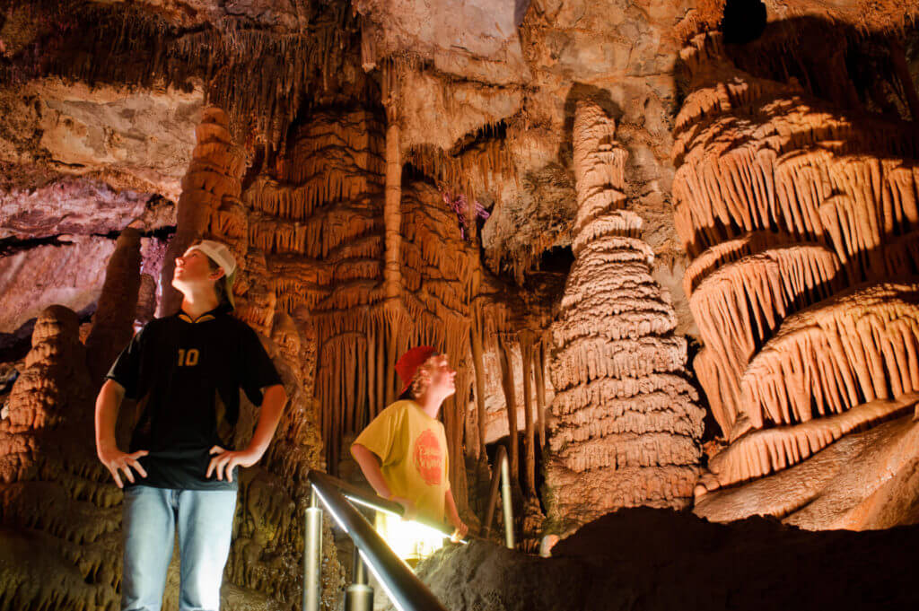
Access to the cave is by guided tours only, May through September, with limited candlelight tours offered in December. Lewis & Clark Caverns State Park also features camping and a network of trails to hike or bike, a state-of-the-art visitor center, interpretive displays, a gift shop, food and beverage concessions, an amphitheater, and interpretive events presented during the summer months.

Looking to camp?

The park has a large campground with 40 campsites, a tipi, and three cabins, which you can reserve online, and a group camping area, which you must contact the park to reserve. There is a $5 charge to use the dump station.

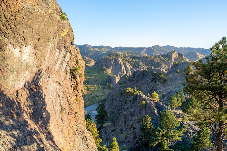
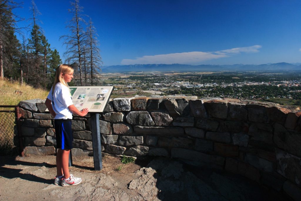
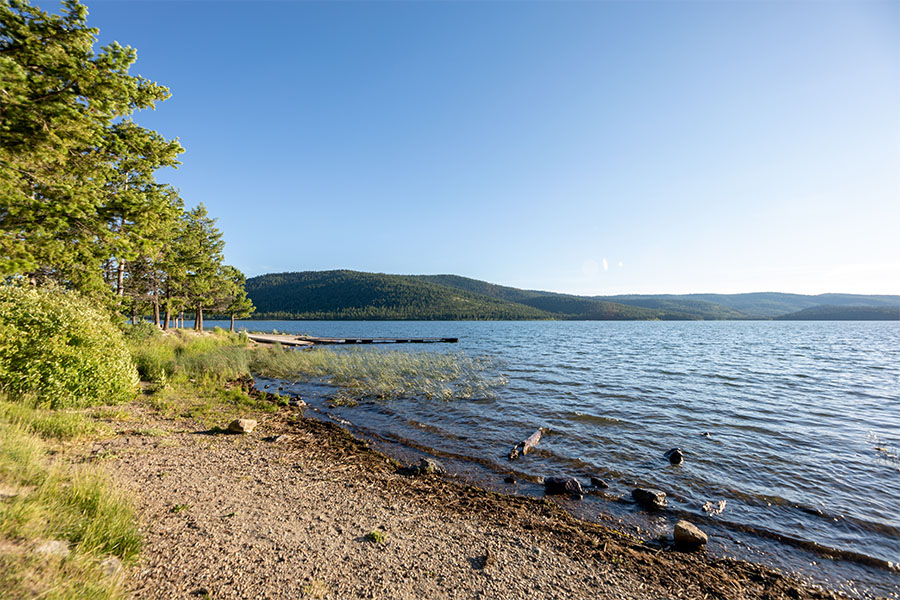
The site encompasses 3,015 acres. The entry area is at an elevation of 4,300 feet and the caverns area is at an elevation of 5,300 feet.

Cave access is only available through the guided tour. You will be asked to please wear a mask. 

Cavern Tours are now being offered. 

The park offers two tours: The Classic Tour, which visits the majority of the developed cave but is physically challenging, and The Paradise tour, that will guide you to the largest, most decorated rooms of the cave. Tour length is approximately 1 mile and the tour takes about 1 1/2 hours.

The tours are first come, first served.

Tickets are limited.

Get in touch with the park for more information. 

Bring a face covering. Face coverings are required during cave tours.

Although optional for other areas of the park. Park disinfecting procedures involve using a bleach solution.

Visitors should consider wearing new or very clean gloves, especially in the caverns where the handrails are cleaned with a bleach solution every tour.

Because of group size restrictions, tours are very limited. Park facilities that are open now are disinfected intermittently. We suggest visitors bring hand sanitizer and/or disinfecting wipes for personal use.

Lewis & Clark Caverns State Park features one of the largest known limestone caverns in the Northwest.

Did You Know

Curious what other visitors have had to say about the park?

"The caverns are amazing and the tours are fantastic. I have been through several times over the years and always loved the experience. The candlelight tours in the winter are amazing for the experience and historic aspects, but the summer tours really show off the caverns with the lights. All of the guides are passionate about their jobs and the caves, and love to teach. Great place to visit and bring friends and family."

"Absolutely beautiful! The bats are very cool to see as well! Can't wait to see it again."

"These Caverns are a jewel. The drive to the caverns winds along the Jefferson River, with cliffs adorning the sides of the road. Our party were excited to to the Caverns today, as it was the rare tour through the cave system with candles!!! This Candlelight tour is offered only at Christmas. What a treat!! The vision of the fellow participants weaving among the cave features is idyllic. It is surprising how much light the candlelight can make in the total dark. This is a best kept secret. The tour guides are top notch."

"A truly fascinating and unique experience! Amazing formations of nature. A true treasure. Outstanding tour and educational experience. Highly recommend!"


Quick Facts
  • pine icon

    Park

    Open Year-Round

  • pine icon

    Visitor Center

    May through September: 9 a.m. - 4:30 p.m. daily

    October through April: 10 a.m. - 4 p.m. daily

  • pine icon

    Water

    Available May through September as weather allows

  • pine icon

    Showers & Comfort Station

    Open through September as weather allows

  • pine icon

    Montana Gift Corral

    8:30 a.m. - 5 p.m. Wednesday through Monday

  • pine icon

    Location

    25 Lewis and Clark Caverns Rd. Whitehall, MT 59759

Lewis & Clark Caverns State Park Read More »

Les Mason State Park

Les Mason State Park

Les Mason State Park

Les Mason State Park

Les Mason State Park is a great day-use spot! With 585 feet of sand and gravel lakeshore, Les Mason is perfect for swimming, cross-country skiing, and picnicking.

Les Mason State Park is the only state park on the east shore of Whitefish Lake. The 585 feet shoreline of sand and gravel beaches and clear blue water are perfect for swimming in the summers.

Les Mason State Park
IMG_5966

Download Park Map

Things to do:

Dogs are only allowed in specifically marked areas of the park and a limited portion of the beach. Dog waste cleanup is very important to stop contamination of the lake.

While this park doesn't have the campgrounds and developed facilities that Whitefish Lake and other State Parks in the area have, it is quiet and serene most of the year with beautiful views of the surrounding mountains on a clear day.

A seasonal swimming dock is anchored just offshore in the summer months.

  • pine icon

    Spend a day on the lake and rent a kayak or canoe from Sea Me Paddle in at Whitefish Lake State Park during the summer

  • pine icon

    Visit downtown Whitefish for shopping, dining, and nightlife

  • pine icon

    Check out the local wildlife, including great birdwatching!

Although there is only a non-motorized boat launch at Les Mason, you can still get out on the water!

Sea Me Paddle Kayaking Tours, Inc., the concessionaire at Whitefish Lake State Park and Les Mason State Park, offers rental equipment, including stand-up paddleboards, kayaks, and pedal boats.

Looking to bring your canine friend along? There is a designated dog swimming area for your furry friend to enjoy!

Be sure to stick around for sunset! The park is in a perfect position to catch great views as the sun sinks into the mountains across the lake.

While Les Mason State Park is open year-round, once the gates are closed for the winter you’ll find you’ll only be able to travel into the park via foot or skis.

Did You Know

Curious what other visitors have had to say about the park?

"A great state park with a large pebble beach, roped off swim area with sunning platform, picnic tables, toilets, and dedicated dog area. Lots of sun here until sunset, and paddle rentals, as well. It gets very busy in summer, so get their early to claim your spot in the sun."

"Most beautiful park in whitefish lake. Shore fishing access and swimming access. Crystal clear water and colorful pebble beach rocks smooth. Ahhhh wish i was there everyday."

"Good place for swimming and the most sun. Clean beach area with pick nick tables in the trees. Beautiful."

"Hidden gem in Whitefish. This is the best beach in town and much less crowded than City Beach. Dog-friendly beach is a perfect spot to people watch and relax a day away. Parking can be a bit tough so get here early! There are limited rentals and bathroom facilities. There are some pit-grills and tables as well. Highly recommend - bit of a drive from town but more than worth it!"


Quick Facts
  • pine icon

    Park

    Park is day use only. 
    Park is open to foot traffic/walk-in only during winter months. 
    Gates will close to vehicles on 10/31/22. 

  • pine icon

    Location

    2650 E. Lake Shore Drive Whitefish, MT 59937

Les Mason State Park Read More »

Lake Mary Ronan State Park

Lake Mary Ronan State Park

Lake Mary Ronan State Park

Lake Mary Ronan State Park is just seven miles west of Flathead Lake.

This park offers a quiet camping opportunity nestled among a boreal forest.

This state park is noted for its fishing and numerous trails that lead into the surrounding areas, which abound in wildflowers and wildlife.

Lake Mary Ronan State Park
IMG_5965

Download Campsite Map

IMG_5966

Download Park Map

IMG_5970

Watch Park Videos

Looking to camp?

Lake Mary Ronan State Park's campground offers 25 campsites, including seasonal electricity at individual campsites, a paved campground road and spurs, plus a new and improved group camping area, boat trailer parking and a boating ramp.
This state park is on 120 acres at an elevation of 3,770 ft.

Off the beaten path just 7 miles west of Flathead Lake, this park is shaded by Douglas fir and western larch.
Lake Mary Ronan provides a quiet opportunity for relaxing, camping, and fishing from either a boat or the parks boat dock. A hiking trail leads into the surrounding area which abound with wildflowers and wildlife.

Several businesses near the park offer a variety of services including food, beverages, bait, and more.

Did You Know

Curious what other visitors have had to say about the park?

"One of my families favorite places to camp. Fishing is great and the campground is quiet"

"Beautiful lodge ,great amenities, extremely lovely and helpful staff. Very excited to come back for a longer stay!"

"Stopped to check out the state campground and lake, very beautiful and peaceful. Dennis, park host, very friendly and knowledgeable of the lake, fishing and surrounding areas. My husband and I are looking forward to camping there."

"Beautiful location. Friendly hosts. Always kept clean and tidy."


Quick Facts
  • pine icon

    Park

    Open

  • pine icon

    Campground 

    Open until late November

  • pine icon

    Electricity

    Available through October

  • pine icon

    Potable water

    Available May through September

  • pine icon

    Dock

    Available during open water

  • pine icon

    Location

    50623 Lake Mary Ronan Rd. Dayton, MT 59860

Parks That Others Are Visiting

Lake Mary Ronan State Park Read More »

Skip to content