Southeast Montana

Yellowstone River

Yellowstone River State Park

Yellowstone River State Park

Yellowstone River State Park

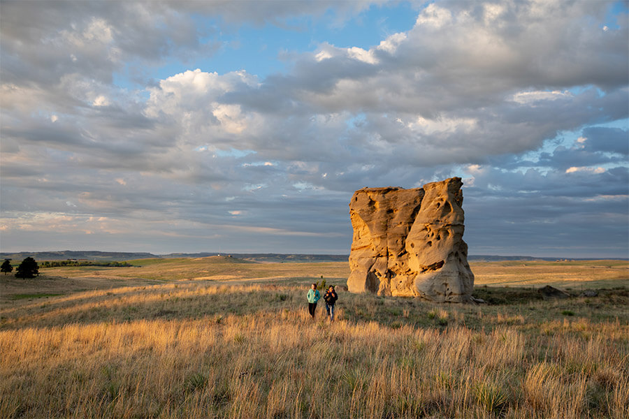
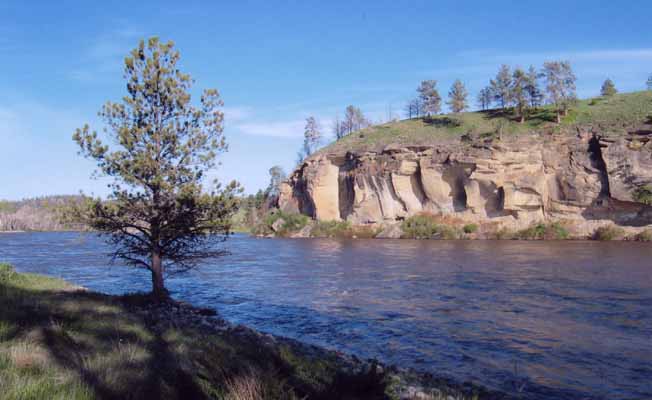
Yellowstone River State Park is just over 200 acres of what used to be the Circle R Ranch, which was purchased by FWP in 2008. Sandstone bluffs, pasturelands, and groves of cottonwood trees surround this unique park.

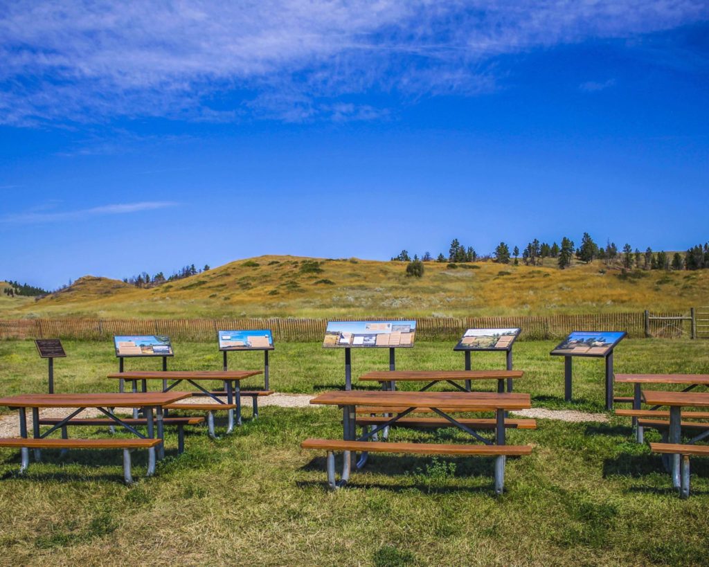
Unlike many state parks across Montana, you won't find many amenities or visitor information kiosks. This undeveloped park is adjacent to Wildlife Management Areas and BLM property, which allows users to experience solitude and quiet only miles from Montana's largest city, Billings.

Yellowstone River State Park

Looking for things to do?

There are many opportunities for recreation along the Yellowstone River.

Gravel along the river from Custer to Sidney often yields Montana agates (inquire locally or through the Custer Country tourism region for guide services or rockhounding tips).

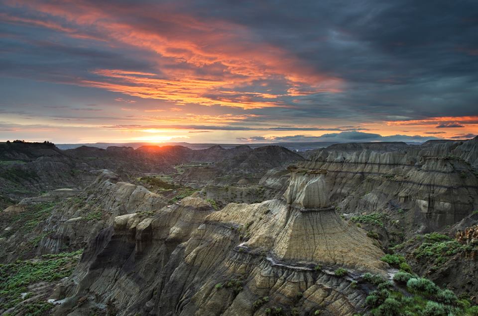
Fishing and floating are two other favorite activities on the Yellowstone. Badlands scenery is abundant in Terry or Makoshika State Park (in Glendive, MT), where you can drive to view impressive rock formations.

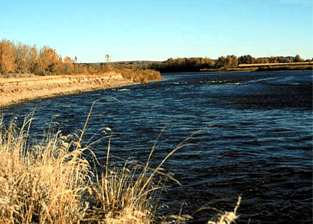
The site contains 3,976 deeded acres and includes 5 miles of wooded Yellowstone River shoreline. The acquisition also secured for the public use of 5,450 acres of Bureau of Land Management (BLM) and state land that had been difficult to access.

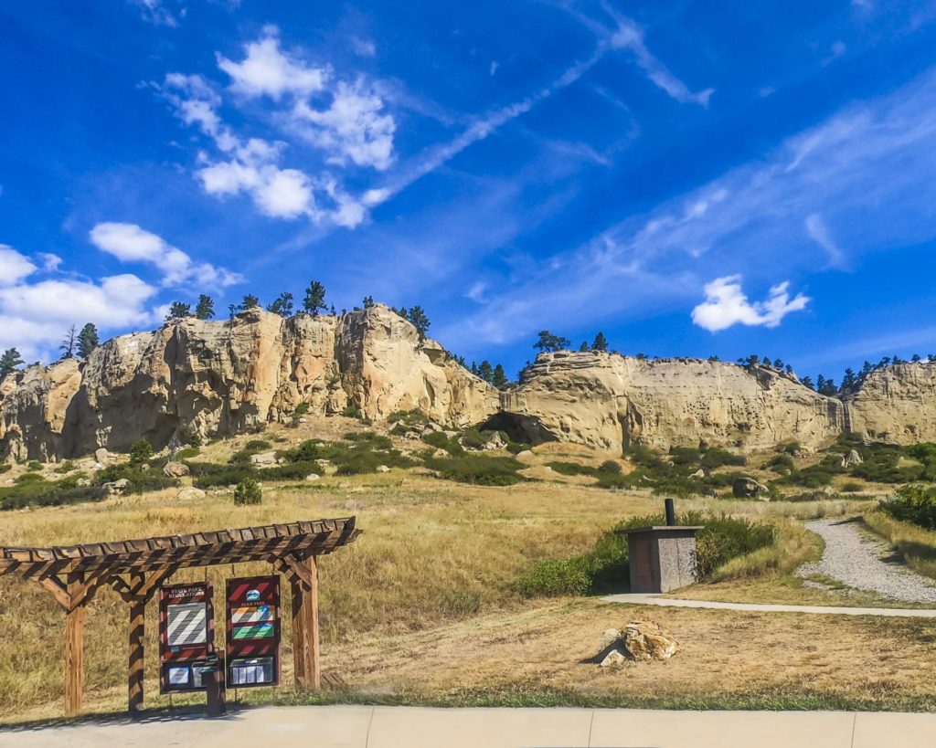
Currently undeveloped, the park provides an ideal spot for hiking the day away. Sandstone bluffs overlook the Yellowstone River while deep canyons and ponderosa pine-lined coulees dot the landscape.

The area provides habitat for mourning doves, meadowlarks, mallards, Canada geese, wild turkeys, pheasants, sage grouse, sharptailed grouse, Hungarian partridge, mule deer, whitetail deer, pronghorn antelope, and even an occasional elk.

The Yellowstone is the last free-flowing river in the lower 48 states. From its headwaters in Lake Yellowstone downstream 670 miles to the Missouri River in North Dakota, the Yellowstone River flows as it has for centuries, in its natural state, undammed and untamed.

Clear, cool, swift and challenging it offers fishermen and river runners some of the best water Montana has to offer.

To fishermen, its blue-ribbon waters are known world round for an abundance of big trout. As it flows through Montana, the big river goes through many changes - from steep-walled canyons where boulders churn its green waters to the eastern part of the state where the river broadens to take a lazy path through fertile farm country.

There are many opportunities for recreation along the Yellowstone River.


Did You Know

Curious what other visitors have had to say about the park?

"Beautiful, spacious, peaceful and fun!"

"It's beautiful here & I heard the fishing is good."

"The only state park in the middle of MT. Nice cottonwoods surround good size lake. Camp spots on the far side are more private and shaded in the afternoon. Beautiful prairie views."


"It is a fun place to hang out for the weekend. Great for fishing year-round."


Quick Facts
  • pine icon

    Park

    Open Year-Round

  • pine icon

    Location

    989 Ackley Lake Road Hobson, MT 59452

Yellowstone River State Park Read More »

Rosebud Battlefield State Park 6

Rosebud Battlefield State Park

Rosebud Battlefield State Park

Rosebud Battlefield State Park

The location of the Battle of Rosebud, is an incredible and historical location that shouldn’t be missed!


Rosebud Battlefield State Park
IMG_5965

Download Campsite Map

The Park History

One of the largest battles of the Indian Wars, the Battle of Rosebud, or “Where the Girl Saved Her Brother” as referred to by the Northern Cheyenne, lasted for eight hours. Because Crook’s troops had been withdrawn from the war zone in order to resupply, they were not there to support Colonel Custer at the Battle of the Little Bighorn one week later.

The battlefield is still used throughout the year by U.S. Armed Forces to study military strategy, including how troops take on an enemy who is familiar with the landscape.

The park includes Kobold Buffalo Jump, a cliff once used by Native Americans and marked with petroglyphs. A short hike within the gap to the cliffs will allow you to see these.

The use of metal detectors, digging and the collecting or removal of artifacts is restricted and bikes are allowed on existing roadways only. Be very cautious while in the park as rattlesnakes reside in the area!

Although camping isn’t available at Rosebud Battlefield, there is camping available at Tongue River Reservoir State Park only 13 miles south.

Rosebud Battlefield is one of the most undeveloped, pristine battlefields in the nation. While looking for the Sioux and Northern Cheyenne villages of Chief Sitting Bull, Brigadier General George Cook, along with 1000 troops and Crow and Shoshone scouts, were unprepared for an organized attack.

On June 17, 1876, an equal or greater number of warriors led by Sioux Chief Crazy Horse and Cheyenne Chiefs Two Moon, Young Two Moons, and Spotted Wolf, attacked the band of soldiers.

Did You Know

Curious what other visitors have had to say about the park?

"What a unique piece of Montana history! The story of the young Cheyenne woman saving her brother against the US Army happened here."

"Great experience. Largest battle in the Indian wars. Very interesting presentation."

"This is the battle that preceded the battle of little big horn by a few days and would have saved Custer if it did not happen. A must see!"

"This is part of our western history few people know of. It was over looked becsuse of Custers actions eight days later."


Quick Facts
  • pine icon

    Park

    Open all year/Day Use Only

  • pine icon

    Location

    42 HC Busby, MT 59016

Rosebud Battlefield State Park Read More »

Pirogue-Island-State-Park

Pirogue Island State Park

Pirogue Island State Park

Pirogue Island State Park

Pirogue Island State Park just a mile north of Miles City, Montana, a little more than two hours from Billings, Montana by way of Interstate 94, and on the north side of a bend in the Yellowstone River.

In addition to extensive hiking, birding, and wildlife viewing, the island is a possible site where the Corps of Discovery and Capt. Clark camped in 1806 on the return voyage of their famous expedition.

We are able to bring you valuable information about this amazing state park thanks to the support of:

Visit Southeast Montana
Pirogue Island Email
IMG_5965

Download Campsite Map

IMG_5966

Download Park Map

Looking to hike?

For visitors who enjoy hiking, Pirogue Island features 2.8 miles of designated hiking trails with interpretive signs offering insights on the history and wildlife of the island. Looking for more than 2.8 miles? You’re in luck!

As a very level site, visitors will find an easy walk throughout the 269 acres and when the water isn’t flowing, visitors can take a walk along the tree-shaded side channels and wade through the pools of water that form during hot weather.

The island boasts prominent plant life with more than 140 species of plants including a healthy population of cottonwood trees, peach-leaf willow, green ash, and red-osier dogwood.

An isolated, cottonwood-covered island located on the Yellowstone River, Pirogue Island State Park is an excellent location for enjoying the natural beauty of Montana. While wading through channels of the Yellowstone River is the most popular way to get to Pirogue Island, others stop by as they float down the river.

Pirogue Island State Park is 500 miles from where the Yellowstone River begins south of Yellowstone National Park and 170 miles from where it ends near Williston, North Dakota.

Did You Know

Curious what other visitors have had to say about the park?

"Growing up in this area I never discovered this until I went back and visited. There is a great trail (about 6 miles) that takes you all around the park and next to the river."

"Good spot for hunting and fishing"

"I love the walking trail and having the chance to see wildlife."

"Great place to view"


Quick Facts
  • pine icon

    Park

    Day use only

    Open year-round, 7 am to 10 pm.

    Mid-August to early April is the best time to cross the channel and reach the island.

  • pine icon

    Location

    Miles City, MT 59301

    Travel north on 59N to the Kinsey Rd/Hwy 489.
    Turn right and follow for 2 miles to the turnoff for Pirogue Island State Park.
    Parking and amenities are at the end of the road.

Pirogue Island State Park Read More »

Pictograph Cave State Park 4

Pictograph Cave State Park

Pictograph Cave State Park

Pictograph Cave State Park

Pictograph Cave State Park lies just outside of Billings, MT. This park features three caves that are preserved and protected in the 23-acre state park.

Along the rimrocks, you'll find where Pictograph Cave has drawn human beings for over 3,000 years and was home to generations of prehistoric hunters.

We are able to bring you valuable information about this amazing state park thanks to the support of:

Visit Southeast Montana
1
IMG_5966

Download Park Map

Looking to camp?

With its abundant wildlife and vegetation, the fertile Yellowstone River valley just north of the park provided an ideal campsite for travelers. Inside the three caves at the park, you can find over 2,100-year-old pictographs from some of Montana's first inhabitants.

When and how these inhabitants arrived is still a mystery and the pictographs they left behind are still subject to great debate.

  • Transport yourself back in time by exploring the caves
  • Check out the Visitor Center and learn more about the history of the caves.
  • Eat your picnic while gazing out at incredible views.
  • Don’t forget to pick up a memento from the gift shop!
  • See if you can spot any wildlife near the caves.

Due to its archeological significance, Pictograph Cave State Park was designated as a National Historic Landmark in 1964. Thousands of years ago, prehistoric hunters who camped in the Pictograph Cave left behind artifacts and over 100 pictographs. The oldest art found at Pictograph Cave State Park is over 2,000 years old and from some of the very first humans on the plains.

The three main caves in the park - Pictograph, Middle, and Ghost - were created from the Eagle sandstone cliff by water and wind erosion. The deepest of the caves, Pictograph Cave, is 160 feet wide and 45 feet deep. In 1936 the first artifacts and paintings were discovered in the caves. Roughly 30,000 artifacts were excavated from the site including, stone tools, weapons, paintings, and instruments. These artifacts helped researchers understand which native people used the caves and when.

In addition to tools and animal bones, the excavations also turned up jewelry, pendants, bracelets, and beads crafted of seashells acquired from Pacific Coast Indians, and in one excavation, researchers discovered barbed harpoon points of the Eskimo culture, made of caribou horn.

At the Park today, you'll see pictographs depicting animals, warriors, and even rifles! The different colors used in the pictographs allowed researchers to identify when people inhabited the region and gave an inside look into their lifestyle. If you’re planning to visit, be sure to bring your binoculars to get the best view of the rock art and be sure to check out the Visitor’s Center which includes interpretive displays and a gift shop.

Depending on the season you can see mountain lions, black bears, turkeys, coyotes, porcupines, red-tailed hawks, golden eagles, bald eagles, northern harriers, bobcats, mountain cottontails, rock doves, turkey vultures, mule deer, canyon wrens, magpies, ravens, crows, and chickadees.

The best time to see the pictographs is after rain or snowmelt! The moisture causes the drawings to become more prominent. And you'll give yourself about an hour to walk the trail with extra time for a picnic and bird watching.

Did You Know

Curious what other visitors have had to say about the park?

"Great place to spend a couple hours, lots of history and dog-friendly. Even in March, it’s a beautiful place to go. Could hear the cracking of the ice on the Yellowstone while looking at the caves."

"Be aware, if you are not from Montana, that you need to be snake smart as this is a habitat for rattlesnakes. Watch where you step and leave them alone if you see one and they will leave you alone."

"Really enjoyed this cave Included the Indian Heritage couple of steep climbs but overall a good walking experience."

"Went here with my kids, great staff and charming volunteers. Nicely laid out park, but I was most struck by realizing that I was standing in a spot that has been inhabited for over 10,000 years. Artifacts from this spot are twice the age of the Great Pyramids of Giza."


Quick Facts
  • pine icon

    Park

    Summer Hours
    Third Friday in May-Third Sunday in September
    Open Daily
    Park: 9 am - 7 pm

    Winter Hours
    Third Monday in September - Third Thursday in May
    Open Wednesday - Sunday
    Park: 9 am - 5 pm
    Closed Monday & Tuesday, and Thanksgiving, Dec. 24, 25, 31 & Jan. 1

  • pine icon

    Visitor Center

    Summer Hours
    Open Daily
    Visitor Center: 10 am - 5 pm

    Winter Hours
    Open Wednesday - Sunday
    Visitor Center: 10 am - 4 pm
    Closed Monday & Tuesday, and Thanksgiving, Dec. 24, 25, 31 & Jan. 1

  • pine icon

    Location

    3401 Coburn Road Billings, MT 59101

Pictograph Cave State Park Read More »

Tongue River Reservoir State Park

Tongue River Reservoir State Park

Tongue River Reservoir State Park

Tongue River Reservoir State Park is located near the southeastern border of Montana, just 10 minutes outside of Decker.

A 265-mile-long tributary of the Yellowstone River, “the Tongue” (as it is called locally) starts in Wyoming and runs through Montana.

The park features a 12-mile long reservoir set in the scenic prairie and bluff lands of southeastern Montana, which is characterized by the striking contrast of red shale and juniper canyons. Due to the rareness of large bodies of water like this in this part of the state, the park can see up to 50,000 visitors a year.

We are able to bring you valuable information about this amazing state park thanks to the support of:

Tongue River Reservoir State Park
IMG_5965

Download Campsite Map

Looking to camp?

81 reservable campsites with electric hookups, and 27 of those are double occupancy with two electric hook-ups. There are also 80 non-reservable, non-electric sites!

At 12 miles long, the reservoir makes for excellent fishing any time of year! You’ll find crappie, walleye, bass, and northern pike here. You can also fly fish below the dam, and a fish cleaning station is located within the park.

Forgot anything or just need additional supplies? The marina at Campers Point has firewood, ice, fishing and boating supplies, boat rentals, boat and RV storage, bait, groceries, snacks, drinks, gasoline, souvenirs, fishing and hunting licenses, and non-resident park passes.

While summertime may be the most popular time to visit the park, Tongue River Reservoir State Park also features amazing ice fishing and year-round campsites that support just that.

  • Take the boat out on the water! There are two boat ramps with docks, one at Campers Point and one at Pee Wee North.
  • Go for a swim! Sand Point has a small beach area for swimming.
  • Keep your eyes open for wildlife! You may see osprey, blue herons, deer, antelope, or bald eagles.
  • Bring your picnic! The designated day-use area has picnic tables at Campers Point and Sand Point.

Tongue River Reservoir has some of the best ice fishing in Montana.

Just ask Chris Jairell of Sheridan, WY who landed a massive 42-inch, 15-pound Tiger Muskie while ice fishing last year.

Tongue River Reservoir boasts miles and miles of ice to test your skill and get you out this winter.

You can also check The Marina's Facebook page to keep tabs on the water and weather conditions. They post regular updates as well as provide an opportunity to share your big fish stories. Just be prepared to provide photographic evidence when you do.

The Marina is also a great place to learn about what you can fish for, ice conditions, and travel tips. You can also call them at (406) 757-2225

Tongue River Reservoir State Park currently holds two state records for the weight of fish caught, including a 37.5 pound Northern Pike?

Did You Know

Curious what other visitors have had to say about the park?

"My most favorite places to go camping and fishing."

"Catch Walleye, Pike, Crappie, Bass, Cats, and MORE!"

"Great place to recreate with shore-side camping, most with electrical hookups available."

"Tongue River Reservoir has the best fishing - they have a wide variety of fish to choose from when They hit they hit you hard. Everything from walleye to catfish to a bluegill sunfish, bass, pike, crappie etc."


Quick Facts
  • pine icon

    Park

    Open Year-Round

  • pine icon

    Campground

    Open Year-Round

    Electricity available at some campgrounds
    Group areas & playground are open

  • pine icon

    Water & Fish Cleaning Stations

    Closed for the season.

    Electricity available at some campgrounds
    Group areas & playground are open

  • pine icon

    Location

    290 Campers Point Decker, MT 59025

Tongue River Reservoir State Park Read More »

Medicine Rocks State Park

Medicine Rocks State Park

Medicine Rocks State Park

The Medicine Rocks are a series of natural rock formations considered sacred by local Native American tribes. They are covered in Native Rock Art or Pictographs.

This magical place is brought to us thanks to the support of:

Visit Southeast Montana
Medicine Rocks State Park
IMG_5965

Download Campsite Map

IMG_5966

Download Park Map

Looking to camp?

Those looking to enjoy the park overnight will find 12 campsites nestled among the Swiss cheese-like rock formations. But be sure to arrive early as all of these sites are first-come, first served.

  • Hike through the prairie and forest or even climb into caves!
  • Take incredible pictures of the rock formations!
  • Enjoy a picnic and enjoy the ever-changing landscape!
  • Keep your eyes open for wildlife, including mule deer, antelope, Woodhouse's toads, and sharp-tailed grouse!
  • Camp at one of the 12 rustic campsites!
  • Stargaze on a clear night or plan a visit during a meteor shower! 

A scenic drive on Montana Highway 7 through rolling hills and prairie, visitors will be amazed by the incredible beauty of Medicine Rocks State Park. As you approach the park you’ll see sandstone pillars, caves archways and towers rising out of the plains with small batches of pine forest in some areas.

But how did these formations come to be?
Around 60-million years ago, the Great Plains were covered by an immense sea. The edges of this sea were swamp-like and forested with a shallow river that cut through carrying sediment from the forming Rocky Mountains. Portions of this sediment were deposited along the path of the river creating sandbars.

Over the years, these sandbars turned to sandstone where wind, water and temperature extremes took their toll.

The stronger materials stayed while the less resistant material was eroded away. The rock that was able to withstand millions of years of erosion now makes up the odd formations found at Medicine Rocks State Park.

Once you’re in the park, a road twists and turns through rock outcroppings taking visitors to the camping and picnic areas. Many of the formations can be viewed from your vehicle, but exploring the park by foot allows visitors to get up close and personal with these rock formations.

Listed on the National Register of Historic Places, Medicine Rocks is also an important cultural site for Native Americans, once used as a vision quest location, meeting place and lookout for bison or enemies.

Many early settlers and cattle drivers carved their names or initials along with the dates they visited into the rocks. You can still find many of these and a complete list of these names can be found in the nearby Carter County Museum!

Did You Know
Quick Facts
  • pine icon

    Park

    Open Year-Round 7 a.m. to 10 p.m.

  • pine icon

    Camping

    Open year-round. Campsites are on a first come first serve basis.

  • pine icon

    Water

    Available Year-Round

  • pine icon

    Location

    1141 Hwy 7 Ekalaka, MT

Curious what other visitors have had to say about the park?

"Really cool, has camping and places to cook out. Hiking is good. The rock formations are great."


"Medicine rocks state park is a beautiful and serene place to visit."

"I saw this park when I was en route to Devil's Tower and decided that, should I ever head out that way again, I would visit it. The park preserves a sand prairie with incredible sandstone. The wildlife viewing was good, as I saw several mule deer and rabbit."

"Lovely, quiet and interesting gem of a state park. We made the hour trip south off 94 and stayed near here on our way west to Yellowstone. We hiked both the loop trail and the short out and back, saw interesting flowers and wildlife. Loved it!"


"Lovely, quiet and interesting gem of a state park. We made the hour trip south off 94 and stayed near here on our way west to Yellowstone. We hiked both the loop trail and the short out and back, saw interesting flowers and wildlife. Loved it!"


"This park is a hidden gem. Very scenic and quiet and peaceful. About 7 camping spots ... my 30' trailer was just about as big as a few spots would accommodate. Clean toilets, potable water. Highly recommend."

"Lovely, quiet and interesting gem of a state park. We made the hour trip south off 94 and stayed near here on our way west to Yellowstone. We hiked both the loop trail and the short out and back, saw interesting flowers and wild life. Loved it!"

"This is an exceptional place to visit. The landscapes are gorgeous and mesmerizing. The quiet walks through the park take you back through the centuries and millennia as you explore the prairies and the sandstone towers. Highly recommend."

"A beautiful place to camp and hike. I am currently attending the Dino Shindig in Ekalaka MT, and this state park is a great addition to the memories I will make in south-eastern MT."

"An unexpected delight! Saw these beautiful rocks while driving by, made a mini detour to drive through the park. Worth the visit!"

Parks That Others Are Visiting

Medicine Rocks State Park Read More »

Makoshika

Makoshika State Park

Makoshika State Park

Makoshika State Park

Makoshika State Park features spectacular badland formations and the remains of the infamous Tyrannosaurus Rex, as well as other amazing dino fossils.

We are able to bring you valuable information about this amazing state park thanks to the support of:

Visit Southeast Montana
Makoshika State Park
IMG_5965

Download Campsite Map

IMG_5966

Download Park Map

Looking to dig for fossils?

The park offers special events throughout the year, including Montana Shakespeare in the Park, Friday night campfire programs and youth programs in summer, and the famous Buzzard Day festival, the second Saturday in June, featuring 10k & 5k races and a fun run, Native American singers & drummers, jumping house, food, disc golf tournament, hikes and more!

Visitors are asked not to bring metal detectors, and no digging, collecting or removal of artifacts is allowed.

Included within the park are an archery site, scenic drives, hiking trails, 28 camping sites, a group picnic area, and an outdoor amphitheater.

The visitor center at the park entrance has interpretive exhibits that are great for kids.

Did You Know

Curious what other visitors have had to say about the park?

"Really cool rock features. Very easy hikes to see amazing views."

"Never a disappointment. I LOVE Makoshika park. I always stop by to visit the ranger's in the gift shop. They are all so very welcoming."

"The scenic overlooks are awesome. Some of the trails are slightly treacherous. Bring water on your walks. The staff are friendly and helpful. The visitor center has some very cool displays of the archeological finds from the area."

"We loved this park. Great views and hiking- decent privacy for spots even though there aren’t really trees to separate the sites. Lots of things to do nearby since it’s so close to town! Wish we had time to take a longer visit and hike more of the trails! Watch out for cacti!"


Quick Facts
  • pine icon

    Park

    Open daily 7:00 a.m. to 10:00 p.m.
    Water available year round

  • pine icon

    Campground 

    Open year round

  • pine icon

    Visitor Center

    Summer Hours

    May 1 – September 30
    Open daily 9:00 a.m. - 5:00 p.m.

    Winter Hours

    October 1 - April 30
    Open Wednesday - Sunday, 10:00 a.m. - 4:00 p.m.
    Closed all federal and state holidays except Memorial Day, Fourth of July, and Labor Day.

  • pine icon

    Location

    1301 Snyder Avenue Glendive, MT 59330

Makoshika State Park Read More »

Lake Elmo State Park

Lake Elmo State Park

Lake Elmo State Park

Inside the city limits of Billings is Lake Elmo State Park. A large 64-acre reservoir, Lake Elmo is the perfect place to swim, paddle, fish, picnic, bird watch, or hike the 1.4-mile nature trail.  The Lake, originally known as Holling Lake Reservoir, was constructed to provide water to irrigated farmland as part of the Carey Land Act of 1894.  The water that fills the man-made lake is diverted from the Yellowstone River near Laurel, MT, and flows through 63 miles of gravity-fed canals before reaching the lake.

We are able to bring you valuable information about this amazing state park thanks to the support of:

Lake Elmo State Park
IMG_5965

Download Trail Map

IMG_5966

Download Park Map

Things to do:

Prior to becoming a State Park in 1983, Lake Elmo was once the site of a two-story restaurant and night club known for dancing, big band music, and two-inch thick T-bone steaks.  Nearby property owners created beaches for swimming and even cleared snow from the lake in the winter to host ice skating.  At once point a thriving boat club was formed by local water skiing and motor boating enthusiasts.

The Regional Office for Montana Fish, Wildlife, and Parks is now located in the park.  The Regional Office houses an impressive collection of taxidermied birds, fish, and wildlife.  You can also purchase conservation licenses and apply for permits at the office which is open weekdays from 8 a.m. to 5 p.m.

A special feature of Lake Elmo is its Dog Park. The 200-square-foot fenced-in area includes a water area and is located on the west side of the lake. Each visitor is allowed a maximum of two dogs in this special area. Dogs must be 4 months or older. Dogs must be on a leash in all other areas of Lake Elmo State Park.

In the 1930s and 1940s, the Lake Elmo Supper Club drew people for dining, dancing, and watching water skiers just out the back door. The Supper Club burned down in 1946, but Lake Elmo continues to be a popular place today.

The reservoir was constructed in 1906 and serves as the storage basin for the Billings Bench Water Association. 

Your four-legged friends will love Lake Elmo State Park as much as you! The dog park at Lake Elmo is a 200-square-foot fenced area that includes access to the water located on the west side of the lake. You and two of your furry friends are allowed to run off-leash in this area, but must be on a leash in all other parts of the park. 

During the summer, the lake is stocked with fish regularly and Roger’s Pier is an excellent fishing spot on the south shore of the lake. And although a popular place to cool off in the summer, the lake can be accessed from many points which means these parks never feel too overcrowded. 

Only non-motorized boating is allowed on the lake though, so you won’t find any water skiing here like you could in the 30s and 40s!

Did You Know

Curious what other visitors have had to say about the park?

"It's basically on the outskirts of town. Fair sized, man made lake with stocked, variety of fish. No motorized craft allowed on the lake. There are picnic shelters, kids play ground, paved parking and restrooms. The water's edge is a work in progress with some beach areas and a boat ramp. No overnight camping. A great day trip."

"I really like this lake, not only is it large enough to explore it has great picknick areas, walking trails. It's very clean and well taken care of."

"Great family place. Canoeing, swimming, and just fun in the sun with people you care about."

"A beautiful lake right in town and watching the sunset there was breathtaking."


Quick Facts
  • pine icon

    Park

    Day Use Only - no camping
    Open daily all year
    5am - 10pm

  • pine icon

    Location

    2300 Lake Elmo Drive Billings, MT 59105

Parks That Others Are Visiting

Lake Elmo State Park Read More »

Chief Plenty Coups State Park

Chief Plenty Coups State Park

Chief Plenty Coups State Park

Chief Plenty Coups State Park is named for the last traditional chief of the Crow Nation, Chief Plenty Coups (Aleek-chea-ahoosh, meaning "many achievements"). Plenty Coups was a man of war - and then a man of peace - whose vision has helped bridge a gap between two cultures.

Recognized for his bravery and leadership, he was made chief of the Apsáalooke (Crow) tribe by age 28. 

We are able to bring you valuable information about this amazing state park thanks to the support of:

Chief Plenty Coups State Park
IMG_5966

Download Park Map

Looking to camp?

On his land, Chief Plenty Coups built a log home, began farming, and eventually opened a general store.

You won’t find camping at Chief Plenty Coups State Park, but you will find a day’s worth of activities!

  • Hike the ¾ mile trail around the grounds and near the creek.
  • Take in the beauty and serenity while enjoying lunch in the picnic area.
  • Bird watching.
  • Learn more about Chief Plenty Coups’ life and Native American culture at the visitor center.
  • Have a fishing license? Try and catch a fish in the creek!

While traveling to Washington D.C., Plenty Coups toured George Washington's estate, Mount Vernon, and was struck by the idea of a national monument open to all.

In 1932, at age 84, Chief Plenty Coups passed away and at his and his wife, Strikes the Iron’s, request, a portion of their homestead was made into a state park which eventually grew to 195 acres for all people to visit and learn from and still operates as such today!

At the burial of the unknown soldier at Arlington Cemetery in 1921, Chief Plenty Coups attended as a representative of all the Indian Nations. While the ceremony commenced, Chief Plenty Coups placed his headdress and two coups sticks on the tomb in honor of the fallen soldiers.

The headdress and coups sticks can still be seen today on display in the Virginia cemetery. Chief Plenty Coups was a well-known statesman and ambassador, he knew several U.S. Presidents and met many foreign leaders during his life. 

Chief Plenty Coups is remembered for helping to bridge the divide between Native American people and white settlers during a time when the Native American people were being coerced into giving up their traditional ways. 

Through the Indian Allotment Act, Chief Plenty Coups received an allotment of land which included a sacred spring, something that Plenty Coups envisioned as a young man, and became one of the first Apsáalooke to own and settle on a farm.

Did You Know

Curious what other visitors have had to say about the park?

"We stopped to eat lunch here. Peaceful place to be. Well taken care of and a lot of pride goes into it."

"Helpful and friendly rangers. Nice historic buildings. Good walking. Beautiful surroundings. Natural spring."

"Friendly museum worker and very informative info about the Chief and his tribe. Nice and easy scenic walk around the grounds."

"It was our first time here and it was truly an emotional experience. So much history to read and the photo books to look through were amazing!! Definitely recommend!"


Quick Facts
  • pine icon

    Park

    Day Use Only. No Camping.

    Summer Hours

    mid-May – mid-September

    Open daily 8 am - 8 pm

    Winter Hours

    Wed-Sunday 8:00am to 5:00pm

    Closed Monday and Tuesday

  • pine icon

    Visitor Center & Chief’s House

    10 am - 5 pm.

    Closed all federal and state holidays except Memorial Day, Fourth of July, and Labor Day. Park is also closed December 24th and 31st.

  • pine icon

    Location

    1 Edgar/Pryor Road

    Pryor, MT 59066

Parks That Others Are Visiting

Chief Plenty Coups State Park Read More »

Skip to content