Montana History

Sluice Boxes State Park

Sluice Boxes State Park

Sluice Boxes State Park

Sluice Boxes State Park was created in 1974 and included significant historic structures and remnants of the abandoned towns of Riceville and Albright that once existed for the purpose of mining limestone in the canyon.

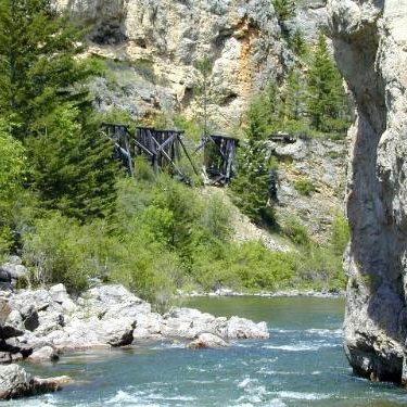
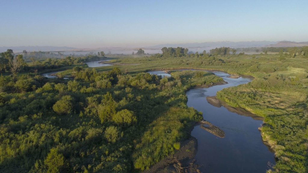
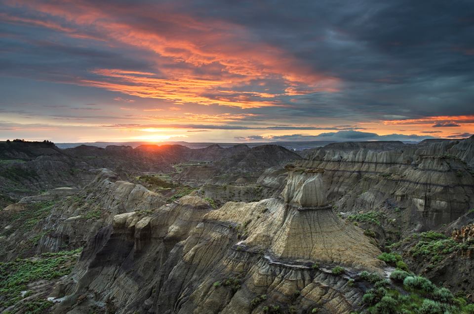
Belt Creek which formed the canyon that is the centerpiece of the park, has long been popular for outdoor recreation. Citizens of nearby Great Falls began visiting the area for fishing, camping, hunting and other activities as early as 1889 when the railroad connecting silver mines in the Barker and Hughesville mining districts to smelters in Great Falls was completed.
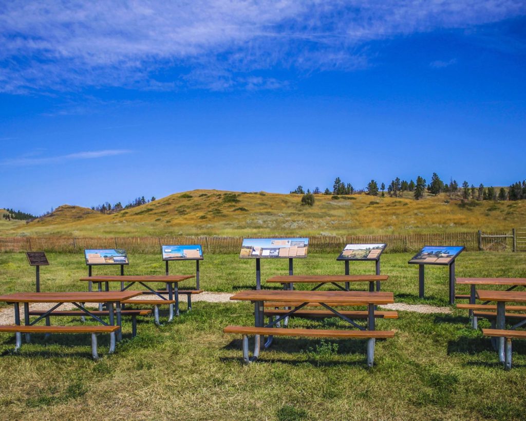
Sluice Boxes State Park
IMG_5965

Download Campsite Map

IMG_5966

Download Park Map

Things to do:

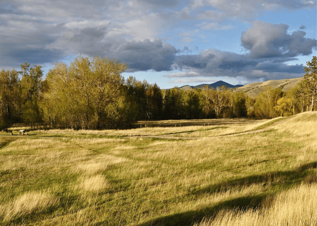
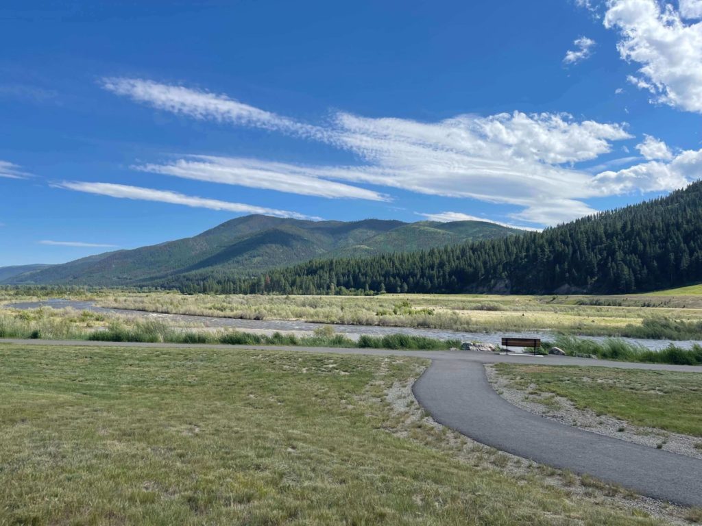
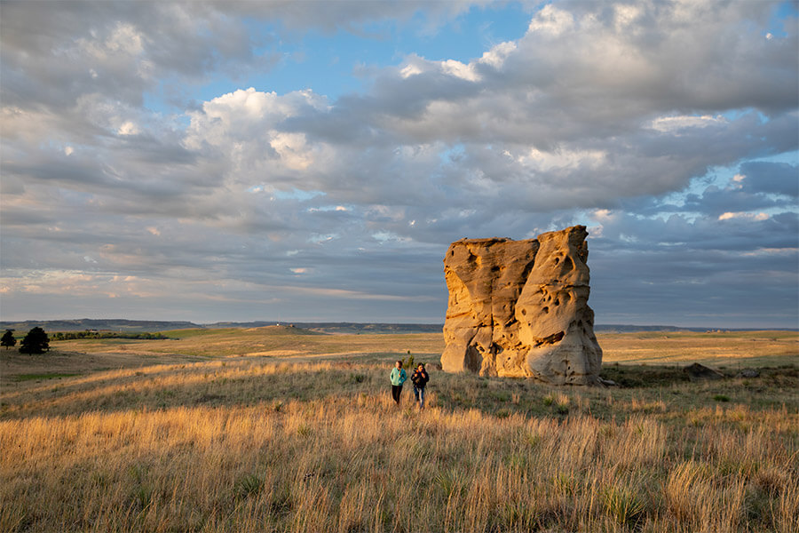
The park is now popular with local visitors, history enthusiasts, fishermen, hikers, and others. The rugged landscape creates dramatic scenery as it contrasts distinctly with the rolling hills and rounded mountains of this part of central Montana.

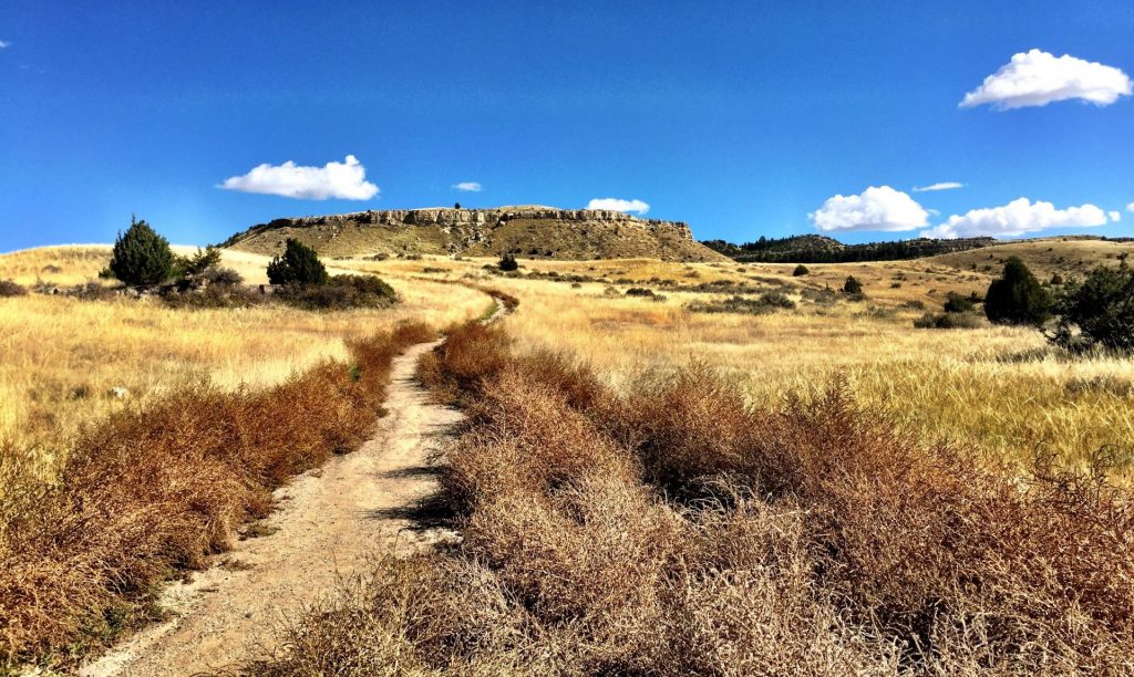
A walk down the old railroad grade trail will bring you to fishing access, floating, swimming and wildlife viewing. Be aware: steep cliffs, rugged terrain and cold, swift water can pose a risk to visitors, so be sure to take caution!

If you’re looking to camp, you’ll need a Backcountry Campsite Permit. You can contact Montana Fish, Wildlife and Parks headquarters in Great Falls to do so.

The Barker Mines and the Montana Central Railroad are part of the history of Sluice Boxes State Park.
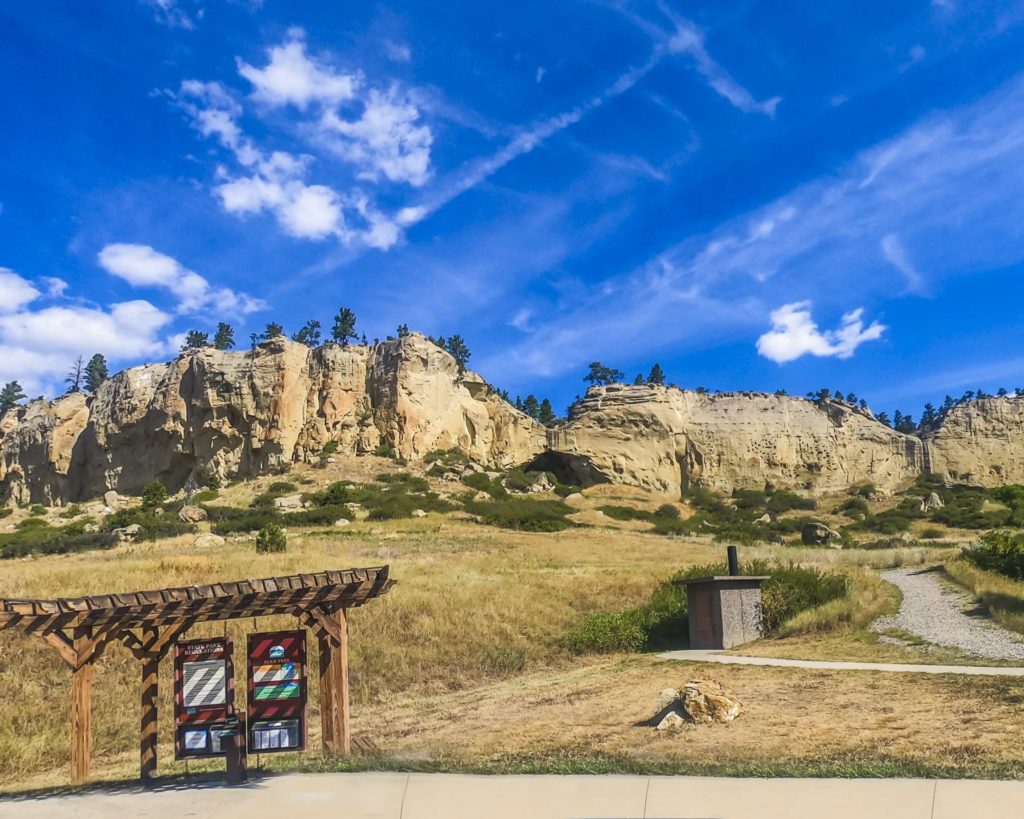
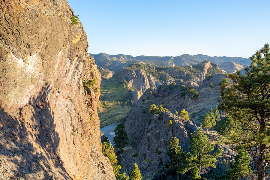
Carved by Belt Creek as it comes down from the Little Belt Mountains, the large limestone cliffs and steep ledges are the signatures of Belt Creek Canyon.

By September of 1890, the Central Montana Railroad dropped off fisherman at various locations along Belt Creek in what is now Sluice Boxes State Park. When Belt Creek was named a blue ribbon trout stream in the 1920s, the railroad ran special “fishing trains” on Sundays.

This area was once home to prospectors searching for precious metals, miners, muleskinners, smelter men and railroaders building bridges. Today, visitors can find the remnants of mines, cabins and a railroad along the banks of Belt Creek in the park.

Did You Know

Curious what other visitors have had to say about the park?

"We stop every trip because the view is gorgeous no matter what the season."

"Beautiful place. Be prepared if you plan on hiking the trail. Lots of river crossings."

"A great place to hike if you don't mind crossing the river several times. It is best to go in the late summer when the river is at its lowest point so that you can cross safely. There is an old homestead to explore as well."

"Family & pet friendly hike. Beautiful for pictures and swimming. There is a spot where you can do a cliff jump into the lake."


Quick Facts
  • pine icon

    Park

    Open all year
    Parking area/ trailhead open sunrise to sunset.

  • pine icon

    Campground

    Backcountry open 24/7

    Permit required

  • pine icon

    Location

    38 Evans Riceville Road Belt, MT 59412

Sluice Boxes State Park Read More »

Rosebud Battlefield State Park 6

Rosebud Battlefield State Park

Rosebud Battlefield State Park

Rosebud Battlefield State Park

The location of the Battle of Rosebud, is an incredible and historical location that shouldn’t be missed!


Rosebud Battlefield State Park
IMG_5965

Download Campsite Map

The Park History

One of the largest battles of the Indian Wars, the Battle of Rosebud, or “Where the Girl Saved Her Brother” as referred to by the Northern Cheyenne, lasted for eight hours. Because Crook’s troops had been withdrawn from the war zone in order to resupply, they were not there to support Colonel Custer at the Battle of the Little Bighorn one week later.

The battlefield is still used throughout the year by U.S. Armed Forces to study military strategy, including how troops take on an enemy who is familiar with the landscape.

The park includes Kobold Buffalo Jump, a cliff once used by Native Americans and marked with petroglyphs. A short hike within the gap to the cliffs will allow you to see these.

The use of metal detectors, digging and the collecting or removal of artifacts is restricted and bikes are allowed on existing roadways only. Be very cautious while in the park as rattlesnakes reside in the area!

Although camping isn’t available at Rosebud Battlefield, there is camping available at Tongue River Reservoir State Park only 13 miles south.

Rosebud Battlefield is one of the most undeveloped, pristine battlefields in the nation. While looking for the Sioux and Northern Cheyenne villages of Chief Sitting Bull, Brigadier General George Cook, along with 1000 troops and Crow and Shoshone scouts, were unprepared for an organized attack.

On June 17, 1876, an equal or greater number of warriors led by Sioux Chief Crazy Horse and Cheyenne Chiefs Two Moon, Young Two Moons, and Spotted Wolf, attacked the band of soldiers.

Did You Know

Curious what other visitors have had to say about the park?

"What a unique piece of Montana history! The story of the young Cheyenne woman saving her brother against the US Army happened here."

"Great experience. Largest battle in the Indian wars. Very interesting presentation."

"This is the battle that preceded the battle of little big horn by a few days and would have saved Custer if it did not happen. A must see!"

"This is part of our western history few people know of. It was over looked becsuse of Custers actions eight days later."


Quick Facts
  • pine icon

    Park

    Open all year/Day Use Only

  • pine icon

    Location

    42 HC Busby, MT 59016

Rosebud Battlefield State Park Read More »

Pictograph Cave State Park 4

Pictograph Cave State Park

Pictograph Cave State Park

Pictograph Cave State Park

Pictograph Cave State Park lies just outside of Billings, MT. This park features three caves that are preserved and protected in the 23-acre state park.

Along the rimrocks, you'll find where Pictograph Cave has drawn human beings for over 3,000 years and was home to generations of prehistoric hunters.

We are able to bring you valuable information about this amazing state park thanks to the support of:

Visit Southeast Montana
1
IMG_5966

Download Park Map

Looking to camp?

With its abundant wildlife and vegetation, the fertile Yellowstone River valley just north of the park provided an ideal campsite for travelers. Inside the three caves at the park, you can find over 2,100-year-old pictographs from some of Montana's first inhabitants.

When and how these inhabitants arrived is still a mystery and the pictographs they left behind are still subject to great debate.

  • Transport yourself back in time by exploring the caves
  • Check out the Visitor Center and learn more about the history of the caves.
  • Eat your picnic while gazing out at incredible views.
  • Don’t forget to pick up a memento from the gift shop!
  • See if you can spot any wildlife near the caves.

Due to its archeological significance, Pictograph Cave State Park was designated as a National Historic Landmark in 1964. Thousands of years ago, prehistoric hunters who camped in the Pictograph Cave left behind artifacts and over 100 pictographs. The oldest art found at Pictograph Cave State Park is over 2,000 years old and from some of the very first humans on the plains.

The three main caves in the park - Pictograph, Middle, and Ghost - were created from the Eagle sandstone cliff by water and wind erosion. The deepest of the caves, Pictograph Cave, is 160 feet wide and 45 feet deep. In 1936 the first artifacts and paintings were discovered in the caves. Roughly 30,000 artifacts were excavated from the site including, stone tools, weapons, paintings, and instruments. These artifacts helped researchers understand which native people used the caves and when.

In addition to tools and animal bones, the excavations also turned up jewelry, pendants, bracelets, and beads crafted of seashells acquired from Pacific Coast Indians, and in one excavation, researchers discovered barbed harpoon points of the Eskimo culture, made of caribou horn.

At the Park today, you'll see pictographs depicting animals, warriors, and even rifles! The different colors used in the pictographs allowed researchers to identify when people inhabited the region and gave an inside look into their lifestyle. If you’re planning to visit, be sure to bring your binoculars to get the best view of the rock art and be sure to check out the Visitor’s Center which includes interpretive displays and a gift shop.

Depending on the season you can see mountain lions, black bears, turkeys, coyotes, porcupines, red-tailed hawks, golden eagles, bald eagles, northern harriers, bobcats, mountain cottontails, rock doves, turkey vultures, mule deer, canyon wrens, magpies, ravens, crows, and chickadees.

The best time to see the pictographs is after rain or snowmelt! The moisture causes the drawings to become more prominent. And you'll give yourself about an hour to walk the trail with extra time for a picnic and bird watching.

Did You Know

Curious what other visitors have had to say about the park?

"Great place to spend a couple hours, lots of history and dog-friendly. Even in March, it’s a beautiful place to go. Could hear the cracking of the ice on the Yellowstone while looking at the caves."

"Be aware, if you are not from Montana, that you need to be snake smart as this is a habitat for rattlesnakes. Watch where you step and leave them alone if you see one and they will leave you alone."

"Really enjoyed this cave Included the Indian Heritage couple of steep climbs but overall a good walking experience."

"Went here with my kids, great staff and charming volunteers. Nicely laid out park, but I was most struck by realizing that I was standing in a spot that has been inhabited for over 10,000 years. Artifacts from this spot are twice the age of the Great Pyramids of Giza."


Quick Facts
  • pine icon

    Park

    Summer Hours
    Third Friday in May-Third Sunday in September
    Open Daily
    Park: 9 am - 7 pm

    Winter Hours
    Third Monday in September - Third Thursday in May
    Open Wednesday - Sunday
    Park: 9 am - 5 pm
    Closed Monday & Tuesday, and Thanksgiving, Dec. 24, 25, 31 & Jan. 1

  • pine icon

    Visitor Center

    Summer Hours
    Open Daily
    Visitor Center: 10 am - 5 pm

    Winter Hours
    Open Wednesday - Sunday
    Visitor Center: 10 am - 4 pm
    Closed Monday & Tuesday, and Thanksgiving, Dec. 24, 25, 31 & Jan. 1

  • pine icon

    Location

    3401 Coburn Road Billings, MT 59101

Pictograph Cave State Park Read More »

Travelers-Rest-state-park

Travelers’ Rest State Park

Travelers' Rest State Park

Travelers’ Rest State Park

Both a state park and a National Historic Landmark, Travelers’ Rest is filled with historical significance. In 2001 the land that Travelers’ Rest State Park resides on was donated to the State of Montana.

After an archeological investigation in 2002, it was discovered that this location was used as a campsite by Lewis & Clark and the Corps of Discovery on two occasions, first from September 9-11 in 1805 and then again the year after from June 30-July 3 in 1806.

Copy of Travelers' Rest
IMG_5965

Download Campsite Map

IMG_5966

Download Park Map

Interested in the history of the park?

During the archeological investigation of the site, archeologists discovered a trench latrine tainted with mercury (a common prescription for many ailments used by the Corps of Discovery), hearths and traces of lead (used in the repair and making of firearms).

The way the camp was set up also led the archeologists to believe that this was the campsite of the Corps of Discovery. The placement of the hearths, latrines and other aspects of the camp were taken from a military manual Lewis & Clark were known to have relied on.

The trace elements in the lead found at the campsite were traced back to elements in Kentucky where Lewis & Clark would have likely gotten their lead! The items found paired with the setup of the camp allowed investigators to come to the conclusion that this was, indeed, the campsite of Lewis & Clark.

  • pine icon

    The park may be called Travelers’ Rest, but that doesn’t mean you can’t be active! Take a hike along Lolo Creek.

  • pine icon

    Learn more about Native American culture from Native storytellers who bring their history and culture to all as part of the programming at Travelers’ Rest.

  • pine icon

    Western Montana is a great place to fish and Travelers’ Rest is no exception! Try your hand at stream or fly fishing in Lolo Creek.

  • pine icon

    History buff? Spend some time in the museum where you’ll find Lewis & Clark Expedition replicas, Salish cultural exhibits, Native American handcrafts, a frontier Main Street and much more!

  • pine icon

    Have a large group? There is a pavilion available to rent! Simply contact the park to make a reservation. Phone: 406-273-4253 Email: [email protected]

  • pine icon

    Looking to enjoy the wildlife? Go bird watching to see how many of the 115 recorded species you can find!

  • pine icon

    Plus so much more!

Travelers’ Rest was also used by Native American tribes in the area. The Salish, Pend d’Oreille and Nez Perce used the area as a campsite and trail junction.

Did You Know

Curious what other visitors have had to say about the park?

"Wonderful state park with great historical significance regarding Lewis and Clark journey of discovery and marvelous natural beauty. If you are near, do not miss this delightful park. Make time for the informatics museum and fun short hikes. I look forward to coming back."

"The kids were brought out here every year by their school, it was always fun and informative of the days gone by. They have Lewis and Clark artifacts that were found on-site for viewing and then some things, just from the era, both give you a nice perspective of how things used to be. The kids and I live close so it's always just a nice place to come hike around check out the creek. It's a great place also for taking photos. I've taken a lot of family photos in this area for people."

"If you're traveling through it's pretty cool place to stop and get educated on the Lewis and Clark travels."

"Great historical park of Lewis and Clark and native Indian camp. Go and walk their trails and learn about their camp. The exhibit at the travelers rest museum is excellent to see their tools, camp life, cooking, wild edibles, and friends. Our family was here for an afternoon and really enjoyed the experience. "


Quick Facts
  • pine icon

    Park

    9:00 am - 5:00 pm daily

    Closed Thanksgiving Day & December 25

  • pine icon

    Visitor Center 

    May 1 - September 30

    9:30 a.m. - 4:30 p.m.

    October 1 - April 30 

    10:00 a.m. - 4:00 p.m. Wednesday-Sunday

    Closed Thanksgiving,  Christmas Eve, Christmas & New Years Day

  • pine icon

    Location

    6717 Highway 12 W Lolo, MT 59847

Travelers’ Rest State Park Read More »

Tower Rock State Park

Tower Rock State Park

Tower Rock State Park

Tower Rock, a 424-foot high rock formation that marks the entrance to the Missouri River Canyon in the Adel Mountains Volcanic Field.

Tower Rock State Park
IMG_5965

Download Campsite Map

IMG_5966

Download Park Map

Want to learn more about the park?

Visitors can learn about geology and history through five interpretive panels located at the trailhead. The trail to the base of the saddle is maintained for a quarter-mile and if you plan to hike this short trail, be sure to keep your eyes open and listen for rattlesnakes!

This day use only park was once used by Native American tribes to mark the entrance to and exit of the buffalo hunting grounds in north central Montana.

Did You Know

Curious what other visitors have had to say about the park?

"The maintained portion of the trail was fabulous. If you go further be sure you have a map from all trails. We couldn't quite figure out the summit, but we had a lovely time. The views are incredible and my 8 and 10 year olds loved it. The pup was exhausted, but he did well, too. Perfect hike near the Missouri River!"

"Great scenery, excellent place for a small hike."

"It is majestic. Volcanic origins. I found seashells when I sat down on the trail and touched the dirt I was sitting on. Makes you think."

"Love hiking Tower Rock. Beautiful scenery!"


Quick Facts
  • pine icon

    Park

    Open Year-Round

  • pine icon

    Location

    2325 Old US HWY 91 Cascade, MT 59421

Tower Rock State Park Read More »

Missouri Headwaters State Park 2

Missouri Headwaters State Park

Missouri Headwaters State Park

Missouri Headwaters State Park

Missouri Headwaters State Park is just outside of Three Forks downtown and only 35 minutes outside of Bozeman. The convergence of the Jefferson, Madison, and Gallatin rivers is the start of the longest river in North America, the Missouri River.  Considered an essential part of the geography of the western U.S.

We are able to bring you valuable information about this amazing state park thanks to the support of:

Missouri Headwaters State Park
IMG_5965

Download Campsite Map

IMG_5966

Download Park Map

Things to do:

Just outside of Three Forks, you’ll find Missouri Headwaters State Park, the confluence of the Madison, Jefferson and Gallatin rivers which form the 2,300 mile Missouri River.

At Missouri Headwaters State Park, you can still find the area looking much as it did historically - with much of the region's abundant wildlife, vegetation, and scenic beauty preserved - making it clear what has attracted people for thousands of years.

  • Looking to camp in history? There are 17 campsites available and you can even rent a tipi!
  • Interpretive displays describing the area’s cultural and natural history can be found to help guide you!
  • Take your bike for a spin on the many trails throughout the park!
  • Not much of a biker? Use the trails for a scenic hike instead!
  • Take a float down the river, you’ll have your choice of three!
  • Visit Fort Rock to take a look at historic pictographs. 

The three rivers that converge to form the Missouri River are named for President Thomas Jefferson, Secretary of State James Madison and Treasury Secretary Albert Gallatin!

The rich, fertile soil along with the proximity to fresh water, brought the Flathead, Bannock and Shoshone Indians to the region and later trappers and settlers, and now this beautiful land has been preserved as a state park for visitors just like you. 

Known for an abundance of wildlife, Missouri Headwaters State Park is a great place to explore, but don’t forget your bug spray! 

In addition to its vast natural resources and outdoor activities, Missouri Headwaters State Park also boasts extensive cultural history - ranging from the tribes that lived there beginning 3,000 years ago to Lewis and Clark to fur traders to settlers.

In late July 1805, William Clark and a small number from the Corps of Discovery reached the Headwaters while scouting for Shoshone Indians, whom they hoped would sell them horses. It was Sacajawea, who recognized the area as where she was captured as a child by the Hidatsa, that led the expedition successfully there.

While at the confluence, Clark left a note for Meriwether Lewis to find and later, Lewis Rock was named for him.

Did You Know

Curious what other visitors have had to say about the park?

"Very interesting spot to see three rivers come together to make the start of the Missouri River."

"Great campground and great camp host! Paul is awesome and hilarious! He also recommended good fishing spots and filled us in on the local moose population, (phone pics included!) This area is spectacular for bird watching, fishing, hiking and taking in some informative L&C history. Restrooms were spotless and smelled nothing like a vault toilet. Even enjoyed a lightning storm on our last night to wrap it all up. Great entertainment! We’ll probably be back in the fall with our little retro trailer for more fishing, exploring and dry-camping."

"We made a spur of the moment trip with 5 other couples from the Bitterroot Valley . Arrived and were met by the campground host, who was not only a character, but had this park and facilities absolutely spit- shined! The "Dogs on leash" rule is strictly enforced, but makes for a more enjoyable stay for all. My two Labradors liked the Host and the camping. Highly recommend."

"Quiet evening to enjoy the view. Be sure and climb up Fort Rock and enjoy the vistas from a little higher up. Easy walk up."


Quick Facts
  • pine icon

    Park

    Open Year-Round

  • pine icon

    Campground

    Open Year-Round​

  • pine icon

    Location

    1585 Trident Road

    Three Forks, MT 5975

Missouri Headwaters State Park Read More »

Milltown State Park 3

Milltown State Park

Milltown State Park

Milltown State Park

On the outskirts of Missoula you’ll find Montana’s newest state park Milltown State Park. Once a Superfund river restoration project, years of hard work from multiple state and federal agencies, non-profits, businesses, and committed volunteers helped make the park what it is today.

We are able to bring you valuable information about this amazing state park thanks to the support of:

Milltown State Park
IMG_5966

Download Park Map

Interpretive displays are placed both at the overlook and confluence areas to provide insight into the history of the area. The story of how people have used the park and the confluence of the Blackfoot and Clark Fork Rivers is told from multiple perspectives in these detailed and interesting displays.

Outdoor opportunities and cultural heritage merge at the restored confluence of the Clark Fork and Blackfoot Rivers at Milltown, providing a unique opportunity for visitors.


The park includes 500 acres of terrain that ranges from restored river bottoms to a pine-forested bluff that overlooks the confluence.

The park affords visitors a place to go hiking, biking, fishing, floating, and watching for birds and wildlife. The Milltown State Park Overlook is open and features interpretive displays and picnic tables. There are nearly three miles of hiking trails that lead from the Overlook down to the Clark Fork River and its floodplain trails. 

The Confluence and Gateway areas, on the north side of the river, saw construction begin in the summer of 2017. The park development include trails, an interpretive plaza, and river access. The grand opening for the Confluence area was June 23, 2018

Among the many stories from the deep past are the Glacial Lake Missoula floods that shaped the landscape thousands of years ago. The Salish and Kalispell know the confluence as the place of bull trout and consider it part of their ancestral home. In 19th century history, Meriwether Lewis made a Fourth of July passage through the confluence and decades later, the Mullan Expedition spent a harsh winter there. Beginning in the 1880s, the rivers were dammed to produce power for the mills and communities but at great consequence.

The hopeful story of the Milltown Dam removal and rivers' return offers an opportunity to explore America's changing relationship to the land as well as the benefits that river restoration yields for Montana's families and communities.

Did You Know

Curious what other visitors have had to say about the park?

"Super pretty day with blue skies. Easy walks for kids and grandparents."

"The State really did a beautiful job on this park it is awe inspiring and a photo in any direction of incredible landscaping."

"Good view, pretty wildflowers, walking trail, picnic table, quiet"

"Great place to relax"


Quick Facts
  • pine icon

    Park

    Open all year. Day Use only. No Camping.

  • pine icon

    Confluence Area gate hours

    October 16 through April 30:  9:00 a.m. – 5:00 pm.

    May 1 through August 31: 9:00 a.m. – 9:00 p.m.

    September 1 through October 15: 9:00 a.m. – 7 p.m.

  • pine icon

    Gateway & Overlook Area hours

    Sunrise to sunset.

  • pine icon

    Location

    Confluence Area

    7363 Juniper Drive

    Missoula, MT 

    Overlook Area

    1353 Deer Creek Road

    Missoula, MT

Milltown State Park Read More »

Medicine Rocks State Park

Medicine Rocks State Park

Medicine Rocks State Park

The Medicine Rocks are a series of natural rock formations considered sacred by local Native American tribes. They are covered in Native Rock Art or Pictographs.

This magical place is brought to us thanks to the support of:

Visit Southeast Montana
Medicine Rocks State Park
IMG_5965

Download Campsite Map

IMG_5966

Download Park Map

Looking to camp?

Those looking to enjoy the park overnight will find 12 campsites nestled among the Swiss cheese-like rock formations. But be sure to arrive early as all of these sites are first-come, first served.

  • Hike through the prairie and forest or even climb into caves!
  • Take incredible pictures of the rock formations!
  • Enjoy a picnic and enjoy the ever-changing landscape!
  • Keep your eyes open for wildlife, including mule deer, antelope, Woodhouse's toads, and sharp-tailed grouse!
  • Camp at one of the 12 rustic campsites!
  • Stargaze on a clear night or plan a visit during a meteor shower! 

A scenic drive on Montana Highway 7 through rolling hills and prairie, visitors will be amazed by the incredible beauty of Medicine Rocks State Park. As you approach the park you’ll see sandstone pillars, caves archways and towers rising out of the plains with small batches of pine forest in some areas.

But how did these formations come to be?
Around 60-million years ago, the Great Plains were covered by an immense sea. The edges of this sea were swamp-like and forested with a shallow river that cut through carrying sediment from the forming Rocky Mountains. Portions of this sediment were deposited along the path of the river creating sandbars.

Over the years, these sandbars turned to sandstone where wind, water and temperature extremes took their toll.

The stronger materials stayed while the less resistant material was eroded away. The rock that was able to withstand millions of years of erosion now makes up the odd formations found at Medicine Rocks State Park.

Once you’re in the park, a road twists and turns through rock outcroppings taking visitors to the camping and picnic areas. Many of the formations can be viewed from your vehicle, but exploring the park by foot allows visitors to get up close and personal with these rock formations.

Listed on the National Register of Historic Places, Medicine Rocks is also an important cultural site for Native Americans, once used as a vision quest location, meeting place and lookout for bison or enemies.

Many early settlers and cattle drivers carved their names or initials along with the dates they visited into the rocks. You can still find many of these and a complete list of these names can be found in the nearby Carter County Museum!

Did You Know
Quick Facts
  • pine icon

    Park

    Open Year-Round 7 a.m. to 10 p.m.

  • pine icon

    Camping

    Open year-round. Campsites are on a first come first serve basis.

  • pine icon

    Water

    Available Year-Round

  • pine icon

    Location

    1141 Hwy 7 Ekalaka, MT

Curious what other visitors have had to say about the park?

"Really cool, has camping and places to cook out. Hiking is good. The rock formations are great."


"Medicine rocks state park is a beautiful and serene place to visit."

"I saw this park when I was en route to Devil's Tower and decided that, should I ever head out that way again, I would visit it. The park preserves a sand prairie with incredible sandstone. The wildlife viewing was good, as I saw several mule deer and rabbit."

"Lovely, quiet and interesting gem of a state park. We made the hour trip south off 94 and stayed near here on our way west to Yellowstone. We hiked both the loop trail and the short out and back, saw interesting flowers and wildlife. Loved it!"


"Lovely, quiet and interesting gem of a state park. We made the hour trip south off 94 and stayed near here on our way west to Yellowstone. We hiked both the loop trail and the short out and back, saw interesting flowers and wildlife. Loved it!"


"This park is a hidden gem. Very scenic and quiet and peaceful. About 7 camping spots ... my 30' trailer was just about as big as a few spots would accommodate. Clean toilets, potable water. Highly recommend."

"Lovely, quiet and interesting gem of a state park. We made the hour trip south off 94 and stayed near here on our way west to Yellowstone. We hiked both the loop trail and the short out and back, saw interesting flowers and wild life. Loved it!"

"This is an exceptional place to visit. The landscapes are gorgeous and mesmerizing. The quiet walks through the park take you back through the centuries and millennia as you explore the prairies and the sandstone towers. Highly recommend."

"A beautiful place to camp and hike. I am currently attending the Dino Shindig in Ekalaka MT, and this state park is a great addition to the memories I will make in south-eastern MT."

"An unexpected delight! Saw these beautiful rocks while driving by, made a mini detour to drive through the park. Worth the visit!"

Parks That Others Are Visiting

Medicine Rocks State Park Read More »

Makoshika

Makoshika State Park

Makoshika State Park

Makoshika State Park

Makoshika State Park features spectacular badland formations and the remains of the infamous Tyrannosaurus Rex, as well as other amazing dino fossils.

We are able to bring you valuable information about this amazing state park thanks to the support of:

Visit Southeast Montana
Makoshika State Park
IMG_5965

Download Campsite Map

IMG_5966

Download Park Map

Looking to dig for fossils?

The park offers special events throughout the year, including Montana Shakespeare in the Park, Friday night campfire programs and youth programs in summer, and the famous Buzzard Day festival, the second Saturday in June, featuring 10k & 5k races and a fun run, Native American singers & drummers, jumping house, food, disc golf tournament, hikes and more!

Visitors are asked not to bring metal detectors, and no digging, collecting or removal of artifacts is allowed.

Included within the park are an archery site, scenic drives, hiking trails, 28 camping sites, a group picnic area, and an outdoor amphitheater.

The visitor center at the park entrance has interpretive exhibits that are great for kids.

Did You Know

Curious what other visitors have had to say about the park?

"Really cool rock features. Very easy hikes to see amazing views."

"Never a disappointment. I LOVE Makoshika park. I always stop by to visit the ranger's in the gift shop. They are all so very welcoming."

"The scenic overlooks are awesome. Some of the trails are slightly treacherous. Bring water on your walks. The staff are friendly and helpful. The visitor center has some very cool displays of the archeological finds from the area."

"We loved this park. Great views and hiking- decent privacy for spots even though there aren’t really trees to separate the sites. Lots of things to do nearby since it’s so close to town! Wish we had time to take a longer visit and hike more of the trails! Watch out for cacti!"


Quick Facts
  • pine icon

    Park

    Open daily 7:00 a.m. to 10:00 p.m.
    Water available year round

  • pine icon

    Campground 

    Open year round

  • pine icon

    Visitor Center

    Summer Hours

    May 1 – September 30
    Open daily 9:00 a.m. - 5:00 p.m.

    Winter Hours

    October 1 - April 30
    Open Wednesday - Sunday, 10:00 a.m. - 4:00 p.m.
    Closed all federal and state holidays except Memorial Day, Fourth of July, and Labor Day.

  • pine icon

    Location

    1301 Snyder Avenue Glendive, MT 59330

Makoshika State Park Read More »

Madison Buffalo Jump State Park

Madison Buffalo Jump State Park

Madison Buffalo Jump State Park

Madison Buffalo Jump State Park

Take a picnic and hike to the top of a buffalo jump for impressive views of the Madison River Valley.

We are able to bring you valuable information about this amazing state park thanks to the support of:

Madison Buffalo Jump State Park
IMG_5965

Download Campsite Map

IMG_5966

Download Park Map

Situated on the edge of a broad valley carved by the Madison River, this high limestone cliff was used by Native Americans for 2,000 years - ending as recently as 200 years ago.

Native people stampeded vast herds of bison off this massive semicircular cliff, using them for food, clothing, shelter and provisions.

"Runners," highly skilled young men trained for speed and endurance, wore buffalo, antelope or wolf skins to lure bison to the "pishkun" or cliff. The buffalo jump was often the key to existence for native peoples.

Although the introduction of horses led to the abandonment of this jump sometime after 1700, the rugged outcropping now serves as an inspiring monument to the region's early inhabitants.

The park includes all the main geographical features of a jump site, and other evidence remains to provide visitors with a glimpse into the cultures that used this hunting style. Interpretive displays help visitors understand the dramatic events that took place here for nearly 2,000 years.

Buffalo bones still lie buried at the cliff's base, and archaeologists have located the tipi rings of an extensive village. With a little imagination, it is easy to visualize the drama of a buffalo drive, the thunderous roar of the stampede, the dramatic sight of the fall, and the frenzy of activity that followed.

Did You Know

Curious what other visitors have to say about the park?

"Cool historic site! Surprisingly this place was chillingly peaceful."

"A good hike, short and sweet. Nice interpretive signage at the end of the .5 mile hike. It's a good place to go to get out of the city for a while!"

"This place is worth the trip a little ways off of the main hiways. The Madison Buffalo Jump has a true unique historic feel to it. You really get the sense with all the info plaques etc. that you can imagine the buffalo careering off the edge. You get a real idea of what the indigenous people went through to survive. I would definitely recommend hiking up to the top either by attacking it straight on, or the easier route around the side."

"Worth the extra drive to get to the trailhead. There is a short mile and a half return hike to the interpretive kiosk and back. Very easy walking and the interpretive displays are very well done. The longer walk will take you to the top of the buffalo jump itself. Some steep climbs involved. It is not half as dangerous at the top as it sounds. The view across to the Madison River is exceptional."

"Wasn't wearing proper hiking attire to hike up the hill, but enjoyed the peaceful songs of the Meadowlarks."

Quick Facts
  • pine icon

    Park

    Open all year
    Daylight hours

  • pine icon

    Location

    6990 Buffalo Jump Road
    Three Forks, MT 59752

Madison Buffalo Jump State Park Read More »

Skip to content