Wildlife Viewing

Pictograph Cave State Park 4

Pictograph Cave State Park

Pictograph Cave State Park

Pictograph Cave State Park

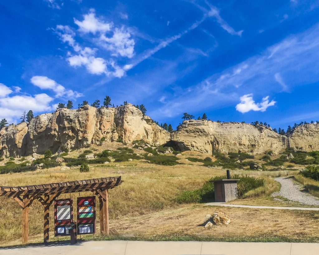
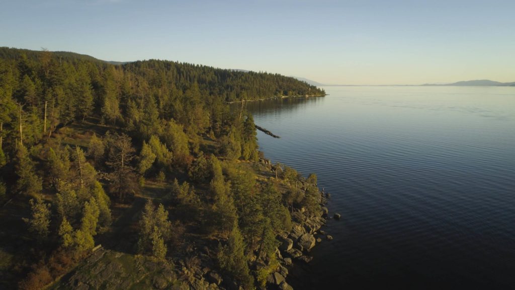
Pictograph Cave State Park lies just outside of Billings, MT. This park features three caves that are preserved and protected in the 23-acre state park.

Along the rimrocks, you'll find where Pictograph Cave has drawn human beings for over 3,000 years and was home to generations of prehistoric hunters.

We are able to bring you valuable information about this amazing state park thanks to the support of:

Visit Southeast Montana
1
IMG_5966

Download Park Map

Looking to camp?

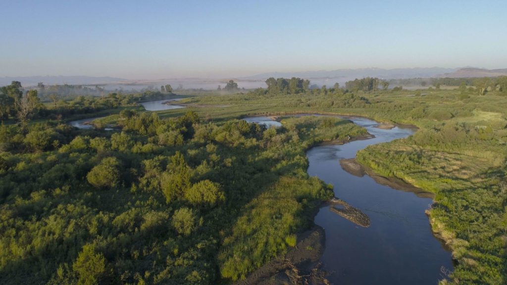
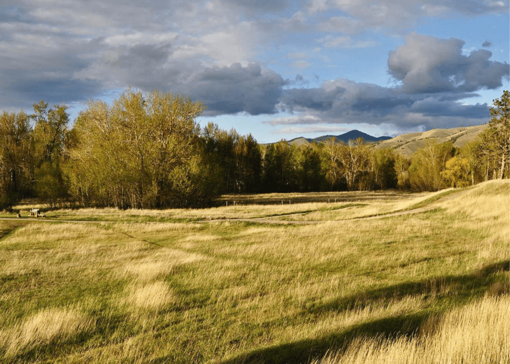
With its abundant wildlife and vegetation, the fertile Yellowstone River valley just north of the park provided an ideal campsite for travelers. Inside the three caves at the park, you can find over 2,100-year-old pictographs from some of Montana's first inhabitants.

When and how these inhabitants arrived is still a mystery and the pictographs they left behind are still subject to great debate.

  • Transport yourself back in time by exploring the caves
  • Check out the Visitor Center and learn more about the history of the caves.
  • Eat your picnic while gazing out at incredible views.
  • Don’t forget to pick up a memento from the gift shop!
  • See if you can spot any wildlife near the caves.

Due to its archeological significance, Pictograph Cave State Park was designated as a National Historic Landmark in 1964. Thousands of years ago, prehistoric hunters who camped in the Pictograph Cave left behind artifacts and over 100 pictographs. The oldest art found at Pictograph Cave State Park is over 2,000 years old and from some of the very first humans on the plains.

The three main caves in the park - Pictograph, Middle, and Ghost - were created from the Eagle sandstone cliff by water and wind erosion. The deepest of the caves, Pictograph Cave, is 160 feet wide and 45 feet deep. In 1936 the first artifacts and paintings were discovered in the caves. Roughly 30,000 artifacts were excavated from the site including, stone tools, weapons, paintings, and instruments. These artifacts helped researchers understand which native people used the caves and when.

In addition to tools and animal bones, the excavations also turned up jewelry, pendants, bracelets, and beads crafted of seashells acquired from Pacific Coast Indians, and in one excavation, researchers discovered barbed harpoon points of the Eskimo culture, made of caribou horn.

At the Park today, you'll see pictographs depicting animals, warriors, and even rifles! The different colors used in the pictographs allowed researchers to identify when people inhabited the region and gave an inside look into their lifestyle. If you’re planning to visit, be sure to bring your binoculars to get the best view of the rock art and be sure to check out the Visitor’s Center which includes interpretive displays and a gift shop.

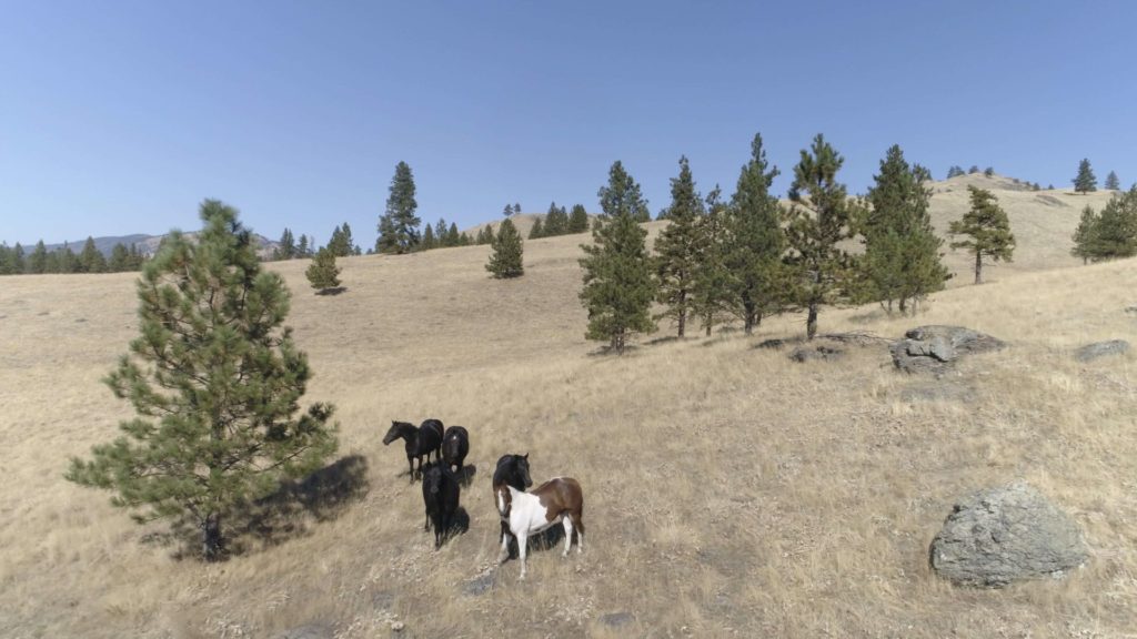
Depending on the season you can see mountain lions, black bears, turkeys, coyotes, porcupines, red-tailed hawks, golden eagles, bald eagles, northern harriers, bobcats, mountain cottontails, rock doves, turkey vultures, mule deer, canyon wrens, magpies, ravens, crows, and chickadees.

The best time to see the pictographs is after rain or snowmelt! The moisture causes the drawings to become more prominent. And you'll give yourself about an hour to walk the trail with extra time for a picnic and bird watching.

Did You Know

Curious what other visitors have had to say about the park?

"Great place to spend a couple hours, lots of history and dog-friendly. Even in March, it’s a beautiful place to go. Could hear the cracking of the ice on the Yellowstone while looking at the caves."

"Be aware, if you are not from Montana, that you need to be snake smart as this is a habitat for rattlesnakes. Watch where you step and leave them alone if you see one and they will leave you alone."

"Really enjoyed this cave Included the Indian Heritage couple of steep climbs but overall a good walking experience."

"Went here with my kids, great staff and charming volunteers. Nicely laid out park, but I was most struck by realizing that I was standing in a spot that has been inhabited for over 10,000 years. Artifacts from this spot are twice the age of the Great Pyramids of Giza."


Quick Facts
  • pine icon

    Park

    Summer Hours
    Third Friday in May-Third Sunday in September
    Open Daily
    Park: 9 am - 7 pm

    Winter Hours
    Third Monday in September - Third Thursday in May
    Open Wednesday - Sunday
    Park: 9 am - 5 pm
    Closed Monday & Tuesday, and Thanksgiving, Dec. 24, 25, 31 & Jan. 1

  • pine icon

    Visitor Center

    Summer Hours
    Open Daily
    Visitor Center: 10 am - 5 pm

    Winter Hours
    Open Wednesday - Sunday
    Visitor Center: 10 am - 4 pm
    Closed Monday & Tuesday, and Thanksgiving, Dec. 24, 25, 31 & Jan. 1

  • pine icon

    Location

    3401 Coburn Road Billings, MT 59101

Pictograph Cave State Park Read More »

Yellow Bay State Park

Yellow Bay State Park

Yellow Bay State Park

One of the six state parks located on Flathead Lake, Yellow Bay is an excellent destination for tent campers!

To get there, visitors will take a drive along the beautiful, winding MT HWY 35 amidst cherry, pear and apple orchards.

As you pass through, remember to stop and explore the local orchards. They offer fresh fruit as well as guided tours!

1
IMG_5965

Download Campsite Map

IMG_5966

Download Park Map

Looking to camp?

Regardless of the water level, boaters usually have no problems putting their boats in at Yellow Bay due to the steepness of its ramp. There are 5 tent campsites, and they are first-come, first-served, so be sure to arrive early to claim your spot!

Yellow Bay Creek flows through the park near the campsites, providing a peaceful sound of cascading water to fall asleep to.
The University of Montana has a renowned Biological station there.

They are the second oldest biological field station in the US and the oldest west of the Mississippi River. They have one of the oldest, contiguous lake data sets in the world.

  • pine icon

    Be on the lookout for birds and plentiful wildlife.

  • pine icon

    Spend a day on the open water boating, canoeing, kayaking or water skiing.

  • pine icon

    A joint tribal/state license will allow you to fish for lake trout.

  • pine icon

    Take a dip in the chilly water.

  • pine icon

    Take a look at what’s under the surface of the water and go scuba diving.

They are currently building an erosion-resistant beach on their portion of the property. They also offer regular community and family activities year round.

Don’t forget to grab fresh fruit from roadside stands or go picking at an orchard during the summer months!

Did You Know

Curious what other visitors have had to say about the park?

"Nice small park tucked away from the heavy traffic of some of the larger parks. Spacious boat launch and a large area to let your water dogs enjoy the lake. Lots of picnic tables- sun and shade. Free day use for Montana residents."

"Clean and cute campground with a camp host and lake access. Plenty of picnic tables and a picnic shelter. Bathroom was clean and stocked with TP and soap."

"Very nice park facing south. We had sun all day. Park Host was very helpful and doing a great job of keeping up with the park. Restrooms had running water and they were clean! No showers but was a hose to wash off after swimming, a must in late summer when swimmers itches is more common. No kids toys but water, rocks, small creek, plenty to do. Enjoyed it very much!"

"Best campground at the lake's shore. Good boat ramp and plenty room to tie boats to shore."


Quick Facts
  • pine icon

    Park

    Open Year-Round

  • pine icon

    Campground 

    Open (Tent camping only; first come, first served)

  • pine icon

    Water

    Available mid-May through Labor Day

  • pine icon

    Flush Toilets

    Open mid-May through Labor Day

  • pine icon

    Dock

    Normally, available mid-March through November, weather permitting. For status please visit our Facebook page or call Flathead Lake State Park Ranger Station, 406-837-3041

    For waves & wind forecast, check NOAA Graphical Flathead Lake Forecast

  • pine icon

    Location

    23861 MT HWY 35 Bigfork, MT 59911

Yellow Bay State Park Read More »

Wild Horse Island State Park 1

Wild Horse Island State Park

Wild Horse Island State Park

Wild Horse Island State Park

Located on Flathead Lake, Wild Horse Island is the largest island in a freshwater lake west of Minnesota.

Accessible only by boat, Wild Horse Island has six boat landing sites, but visitors are welcome to pull their boats to shore on any of the public beach sites.

While most of the island is a state park, be aware as there is still private shoreline, therefore visitors are prohibited from using the boat docks.

Wild Horse Island State Park
IMG_5965

Download Campsite Map

IMG_5966

Download Park Map

Looking to hike?

Due to the variety of wildlife, Wild Horse Island does not allow camping, pets or bikes as they may spook the animals. Fires and smoking are prohibited anywhere on the island.

What can you do at Wild Horse Island? The question is, what can’t you do?! You can:
Take a hike! The island has four miles of interconnected hiking trails, but visitors are free to explore off-trail as well.

  • Try and catch your dinner! Fishing is allowed with tribal & state fishing licenses.
  • Check out the wildlife including bighorn sheep, mule deer, songbirds, waterfowl, bald eagles, falcons and wild horses.
  • Warm day? Take a dip in Flathead Lake!
  • Pack a picnic lunch to enjoy while you enjoy the views.

Wild Horse Island is said to have been used by the Salish-Kootenai Indians who would pasture their horses on the island to prevent them from being stolen by other tribes!

Wild Horse Island used to be farmed and in the 30s even hosted a lodge. Visitors can still find apple and pear orchards, so if you’re feeling peckish, grab a snack! Besides the great views and interesting wildlife, you can also find rare, endangered plant life on Wild Horse Island. The island even has a Palouse Prairie ecosystem, one of only three of these biomes in Montana!

Did You Know

Curious what other visitors have had to say about the park?

"Beautifully untouched for the most part. There are 5 horses currently on island and 1 bear, that we saw neither of. Lol. However it was abundant with bald eagles, osprey, deer, and bighorn sheep. Most of which you can view from a boat offshore if you have a keen eye. If not get a guided tour. But no tours are given on island, just to and from."

"Great place to boat to and relax. Beautiful water and fun rocks to skip!"

"Beautiful island to cruise around and we caught the 5 wild horses on the Western side!"

"Island in flathead lake with a few hiking trails and animals. Worth a visit during the day, or coming over by boat closer to dusk to see the deer, sheep, and possibly horses as they come down to drink."


Quick Facts
  • pine icon

    Park

    Open Year Round

  • pine icon

    Restrictions/Closures

    Fires & Smoking Prohibited
    Groups 15 and over must have a special permit.

  • pine icon

    Location

    Flathead Lake
    Latitude/Longitude:
    (47.84715/-114.23458)

Wild Horse Island State Park Read More »

WhitefishLakeStateParkView

Whitefish Lake State Park

Whitefish Lake State Park

Whitefish Lake State Park

A quick drive, walk, or bike ride from downtown Whitefish, you’ll find Whitefish Lake State Park or just State Park as the locals call it. Part of the Whitefish hiking and biking trail system, this park has something for everyone!

Whitefish Lake State Park
IMG_5965

Download Campsite Map

IMG_5966

Download Park Map

Looking to camp?

Whitefish Lake is host to 25 campsites made up of a mix of tent only, bike travel, and RV camping. You’re sure to find what you need if you plan to stay a night or two!

Many of the campsites here have a secluded feeling as they’re divided by tall trees. If you plan to bring in your RV or trailer, be aware that RV/trailer length is limited to 40 feet.

Kids love watching trains move just along the park’s edge near the campground!

A new hike and bike campsite is perfect for cyclists traveling along the Great Divide route!

The lake is rarely windy making is the perfect destination for water-skiing and other water activities!

Stand-up paddleboards, kayaks, and pedal boats are available to rent June 15-Labor Day from Sea Me Paddle Kayaking Tours, Inc. Be sure to call ahead as hours of operation vary! You can reach them at 406-249-1153.

While the shallow water at the beach isn’t known for swimming, your four-legged friend will love the designated swimming area for dogs!

Did You Know

Curious what other visitors have had to say about the park?

"Clean and well organized. Park rangers enforce the law properly"

"Nice clean campground. Friendly hosts. Easy access to lake. Perfect for swimming and for the pups. Decent public restrooms"

"Great little camp ground with a dog exercise/swimming area, huge beachfront picnic area, boat launch, with spacious, semi-private campsites. The best part though was the helpful, friendly staff! We'll be back! Also, very close to the Whitefish Trail system, some of the best mountain biking/hiking in the Northwest!"

"Really nice quiet place with amazing views of big mountain."


Quick Facts
  • pine icon

    Park

    Open

    Gates Closed December - April

  • pine icon

    Campground

    Open

  • pine icon

    Water and showers

    Open

  • pine icon

    Location

    1615 W Lakeshore Whitefish, MT 59937

Whitefish Lake State Park Read More »

West Shore State Park 2

West Shore State Park

West Shore State Park

West Shore State Park

West Shore State Park is located just outside of Lakeside, MT and is open year-round!

There, you will find glacially-carved rock outcrops within the park where you’ll have incredible views of Flathead Lake and the Mission and Swan Mountains Ranges.

West Shore State Park
IMG_5965

Download Campsite Map

IMG_5966

Download Park Map

Looking to hike?

All of the hiking trails at the park are single-track dirt trails that range from steep and laborious to gradual, contoured and easy-going. Pets are welcome on a leash.

West Shore has a dock so long that boats can use it year-round (including winter!) when the lake is low. Experience the tranquil atmosphere while camping in a forest of fir, pine and larch above Flathead Lake.

There are 31 campsites available with seven being tent only. If you plan to bring your RV or trailer, make sure it’s no more than 40 feet.

  • pine icon

    Take in the unique topography of West Shore State Park on 4 miles of hiking trails along the rocky shoreline.

  • pine icon

    Bring your joint state/tribal fishing license and take your shot at catching dinner from the lake!

  • pine icon

    Spend a day on the lake and rent a kayak or canoe from Sea Me Paddle in Lakeside or at the Park during the summer.

  • pine icon

    Enjoy the beach and then cool off with a dip in chilly Flathead Lake.

  • pine icon

    Check out the local wildlife, including great birdwatching!

West Shore has a dock so long that boats can use it year-round (including winter!) when the lake is low. Experience the tranquil atmosphere while camping in a forest of fir, pine and larch above Flathead Lake.

Did You Know

Curious what other visitors have had to say about the park?

"We just stopped here to relax a bit. The park is in a nice forest with lake access. There is also a small trail inside the park which leads to a nice vista point."

"This Lake brings back so many childhood memories there is a single spot of this like that I don't love!"

"Good trails. Beautiful shore line. Camping spots look good, not too close together."

"SO pretty!!! I just want to LIVE here!"


Quick Facts
  • pine icon

    Park

    Open

  • pine icon

    Campground 

    Open

  • pine icon

    Potable water

    May through September

  • pine icon

    Dock

    For status updates please visit our Facebook page or call Flathead Lake State Park, 406-837-3041.
    For waves & wind forecast, check NOAA Graphical Flathead Lake Forecast

  • pine icon

    Location

    17768 MT Hwy 93 Lakeside, MT 59922

West Shore State Park Read More »

Wayfarers State Park 2

Wayfarers State Park

Wayfarers State Park

Wayfarers State Park

Located on the northeast shore of Flathead Lake near Bigfork, you’ll find Wayfarers State Park. This park, while small, has so much to offer!

Wayfarers State Park
IMG_5965

Download Campsite Map

IMG_5966

Download Park Map

IMG_5964

Download Brochure

Looking to camp?

From spring to late fall, the area abounds in wildflowers. Nature walks over the rocky shoreline to the cliffs are popular with photographers for an excellent view of Flathead Lake. There are 30 campsites in the park, including a hike-bike campsite with 9 tent pads, convenient for cyclists traveling the nearby Continental Divide route.

The maximum length for RV/trailer units is 40 feet. Starting in spring and into the late fall, Wayfarers is full of wildflowers! The best part of Wayfarers State Park? Its location along the northeastern part of Flathead Lake makes it one of the ideal places to watch the sunset over the lake and sink behind the mountains.

While close enough to Bigfork to walk, the mature mixed forest of Wayfarers makes it a great place for camping and picnicking. Located near the quaint resort town of Bigfork on the northeast shore of Flathead Lake, this park is 67 acres in size and is 2,923 feet in elevation. A mature mixed forest makes this site very pleasant for camping and picnicking.

Did You Know

Curious what other visitors have had to say about the park?

"Really nice park with lots of room. Nice water access very close to Bigfork. Well kept."

"Great place to camp and beautiful views of the lake!"

"Great for all ages. There were tons of families but we were able to find a whole other section with rocks to jump off of. So much fun."

"When passing through Big Fork, we often make Wayfarers our lunch stop destination. A good chance to stretch the legs, gaze out over the water, and enjoy lunch. We have camped here as well. Can be very crowded mid-summer so make a reservation. Some sites are very tight."


Quick Facts
  • pine icon

    Park

    Open Year-Round. Day-use open from 7 AM to 10 PM daily.

  • pine icon

    Campground

    Open April through October

  • pine icon

    Water and Shower House

    Available May through September.

  • pine icon

    Dock

    Contact park for availability.
    Dock is unusable when lake level is low.
    Typically lake level is high enough mid-June through early-September.
    For Waves & Wind Forecast, check NOAA Graphical Flathead Lake Forecast

  • pine icon

    Location

    8600 MT. Hwy 35 Bigfork, MT 59911

Wayfarers State Park Read More »

Travelers-Rest-state-park

Travelers’ Rest State Park

Travelers' Rest State Park

Travelers’ Rest State Park

Both a state park and a National Historic Landmark, Travelers’ Rest is filled with historical significance. In 2001 the land that Travelers’ Rest State Park resides on was donated to the State of Montana.

After an archeological investigation in 2002, it was discovered that this location was used as a campsite by Lewis & Clark and the Corps of Discovery on two occasions, first from September 9-11 in 1805 and then again the year after from June 30-July 3 in 1806.

Copy of Travelers' Rest
IMG_5965

Download Campsite Map

IMG_5966

Download Park Map

Interested in the history of the park?

During the archeological investigation of the site, archeologists discovered a trench latrine tainted with mercury (a common prescription for many ailments used by the Corps of Discovery), hearths and traces of lead (used in the repair and making of firearms).

The way the camp was set up also led the archeologists to believe that this was the campsite of the Corps of Discovery. The placement of the hearths, latrines and other aspects of the camp were taken from a military manual Lewis & Clark were known to have relied on.

The trace elements in the lead found at the campsite were traced back to elements in Kentucky where Lewis & Clark would have likely gotten their lead! The items found paired with the setup of the camp allowed investigators to come to the conclusion that this was, indeed, the campsite of Lewis & Clark.

  • pine icon

    The park may be called Travelers’ Rest, but that doesn’t mean you can’t be active! Take a hike along Lolo Creek.

  • pine icon

    Learn more about Native American culture from Native storytellers who bring their history and culture to all as part of the programming at Travelers’ Rest.

  • pine icon

    Western Montana is a great place to fish and Travelers’ Rest is no exception! Try your hand at stream or fly fishing in Lolo Creek.

  • pine icon

    History buff? Spend some time in the museum where you’ll find Lewis & Clark Expedition replicas, Salish cultural exhibits, Native American handcrafts, a frontier Main Street and much more!

  • pine icon

    Have a large group? There is a pavilion available to rent! Simply contact the park to make a reservation. Phone: 406-273-4253 Email: [email protected]

  • pine icon

    Looking to enjoy the wildlife? Go bird watching to see how many of the 115 recorded species you can find!

  • pine icon

    Plus so much more!

Travelers’ Rest was also used by Native American tribes in the area. The Salish, Pend d’Oreille and Nez Perce used the area as a campsite and trail junction.

Did You Know

Curious what other visitors have had to say about the park?

"Wonderful state park with great historical significance regarding Lewis and Clark journey of discovery and marvelous natural beauty. If you are near, do not miss this delightful park. Make time for the informatics museum and fun short hikes. I look forward to coming back."

"The kids were brought out here every year by their school, it was always fun and informative of the days gone by. They have Lewis and Clark artifacts that were found on-site for viewing and then some things, just from the era, both give you a nice perspective of how things used to be. The kids and I live close so it's always just a nice place to come hike around check out the creek. It's a great place also for taking photos. I've taken a lot of family photos in this area for people."

"If you're traveling through it's pretty cool place to stop and get educated on the Lewis and Clark travels."

"Great historical park of Lewis and Clark and native Indian camp. Go and walk their trails and learn about their camp. The exhibit at the travelers rest museum is excellent to see their tools, camp life, cooking, wild edibles, and friends. Our family was here for an afternoon and really enjoyed the experience. "


Quick Facts
  • pine icon

    Park

    9:00 am - 5:00 pm daily

    Closed Thanksgiving Day & December 25

  • pine icon

    Visitor Center 

    May 1 - September 30

    9:30 a.m. - 4:30 p.m.

    October 1 - April 30 

    10:00 a.m. - 4:00 p.m. Wednesday-Sunday

    Closed Thanksgiving,  Christmas Eve, Christmas & New Years Day

  • pine icon

    Location

    6717 Highway 12 W Lolo, MT 59847

Travelers’ Rest State Park Read More »

Tongue River Reservoir State Park

Tongue River Reservoir State Park

Tongue River Reservoir State Park

Tongue River Reservoir State Park is located near the southeastern border of Montana, just 10 minutes outside of Decker.

A 265-mile-long tributary of the Yellowstone River, “the Tongue” (as it is called locally) starts in Wyoming and runs through Montana.

The park features a 12-mile long reservoir set in the scenic prairie and bluff lands of southeastern Montana, which is characterized by the striking contrast of red shale and juniper canyons. Due to the rareness of large bodies of water like this in this part of the state, the park can see up to 50,000 visitors a year.

We are able to bring you valuable information about this amazing state park thanks to the support of:

Tongue River Reservoir State Park
IMG_5965

Download Campsite Map

Looking to camp?

81 reservable campsites with electric hookups, and 27 of those are double occupancy with two electric hook-ups. There are also 80 non-reservable, non-electric sites!

At 12 miles long, the reservoir makes for excellent fishing any time of year! You’ll find crappie, walleye, bass, and northern pike here. You can also fly fish below the dam, and a fish cleaning station is located within the park.

Forgot anything or just need additional supplies? The marina at Campers Point has firewood, ice, fishing and boating supplies, boat rentals, boat and RV storage, bait, groceries, snacks, drinks, gasoline, souvenirs, fishing and hunting licenses, and non-resident park passes.

While summertime may be the most popular time to visit the park, Tongue River Reservoir State Park also features amazing ice fishing and year-round campsites that support just that.

  • Take the boat out on the water! There are two boat ramps with docks, one at Campers Point and one at Pee Wee North.
  • Go for a swim! Sand Point has a small beach area for swimming.
  • Keep your eyes open for wildlife! You may see osprey, blue herons, deer, antelope, or bald eagles.
  • Bring your picnic! The designated day-use area has picnic tables at Campers Point and Sand Point.

Tongue River Reservoir has some of the best ice fishing in Montana.

Just ask Chris Jairell of Sheridan, WY who landed a massive 42-inch, 15-pound Tiger Muskie while ice fishing last year.

Tongue River Reservoir boasts miles and miles of ice to test your skill and get you out this winter.

You can also check The Marina's Facebook page to keep tabs on the water and weather conditions. They post regular updates as well as provide an opportunity to share your big fish stories. Just be prepared to provide photographic evidence when you do.

The Marina is also a great place to learn about what you can fish for, ice conditions, and travel tips. You can also call them at (406) 757-2225

Tongue River Reservoir State Park currently holds two state records for the weight of fish caught, including a 37.5 pound Northern Pike?

Did You Know

Curious what other visitors have had to say about the park?

"My most favorite places to go camping and fishing."

"Catch Walleye, Pike, Crappie, Bass, Cats, and MORE!"

"Great place to recreate with shore-side camping, most with electrical hookups available."

"Tongue River Reservoir has the best fishing - they have a wide variety of fish to choose from when They hit they hit you hard. Everything from walleye to catfish to a bluegill sunfish, bass, pike, crappie etc."


Quick Facts
  • pine icon

    Park

    Open Year-Round

  • pine icon

    Campground

    Open Year-Round

    Electricity available at some campgrounds
    Group areas & playground are open

  • pine icon

    Water & Fish Cleaning Stations

    Closed for the season.

    Electricity available at some campgrounds
    Group areas & playground are open

  • pine icon

    Location

    290 Campers Point Decker, MT 59025

Tongue River Reservoir State Park Read More »

Painted Rocks State Park

Painted Rocks State Park

Painted Rocks State Park

Named for the green, yellow and orange lichens that cover the grey and black walls of the granite and rhyolite cliffs, Painted Rocks State Park is located in the West Fork Valley of the Bitterroot Mountains.

We are able to bring you valuable information about this amazing state park thanks to the support of:

1
IMG_5965

Download Campsite Map

Looking to camp?

Painted Rocks State Park offers 25 campsites, a boat ramp and a boat dock. Be sure if you’re bringing your trailer or RV that it’s no longer than 25 feet!

And if you like to hike, there are many trailheads near the park that offer access to national forest land. 

Painted Rocks Dam was originally planned to be constructed for agricultural use!

The Montana Water Conservation started work on Painted Rock Dam in 1939. Today, Painted Rocks Reservoir provides water for irrigation, stock water, domestic use and in-stream flows for fish. The reservoir the dam creates is the perfect location for boating or fishing!

While in the park, keep your eyes open for the diverse populations of wildlife including elk, mule deer, white-tailed deer, black bear or moose! You may even catch a glimpse of bighorn sheep or peregrine falcons which were reintroduced to the area in the 1980s.

Are you or do you know an avid birdwatcher? If you happen to be in the area in the spring or fall, you’re in luck! Osprey, great blue heron, water ouzels, spotted sandpiper and kill-deer make pitstops in their migration patterns at Painted Rocks State Park.

Part of the homeland of the Salish people for many years, this area continues to be a place of great value to the Salish. The area did, and still does, provide great hunting and a place to gather traditional foods such as huckleberries, serviceberries, Bitterroot, trout, as well as other fish and mountain tea. 

Did You Know

Curious what other visitors have had to say about the park?

"It was beautiful! I've been here many times but this is the first time I kayaked it. Absolutely smooth as glass on the most perfect sunshiny day."

"Beautiful, peaceful, wonderful place to spend time with the family."

"What is not to love. So worth the drive."

"Lovely scenery, very peaceful. Saw my first big horn sheep in the wild here. It was amazing"


Quick Facts
  • pine icon

    Park

    Open Year-Round

    Dawn to Dusk

  • pine icon

    Location

    8809 West Fork Road Darby, MT 59829

Painted Rocks State Park Read More »

Missouri Headwaters State Park 2

Missouri Headwaters State Park

Missouri Headwaters State Park

Missouri Headwaters State Park

Missouri Headwaters State Park is just outside of Three Forks downtown and only 35 minutes outside of Bozeman. The convergence of the Jefferson, Madison, and Gallatin rivers is the start of the longest river in North America, the Missouri River.  Considered an essential part of the geography of the western U.S.

We are able to bring you valuable information about this amazing state park thanks to the support of:

Missouri Headwaters State Park
IMG_5965

Download Campsite Map

IMG_5966

Download Park Map

Things to do:

Just outside of Three Forks, you’ll find Missouri Headwaters State Park, the confluence of the Madison, Jefferson and Gallatin rivers which form the 2,300 mile Missouri River.

At Missouri Headwaters State Park, you can still find the area looking much as it did historically - with much of the region's abundant wildlife, vegetation, and scenic beauty preserved - making it clear what has attracted people for thousands of years.

  • Looking to camp in history? There are 17 campsites available and you can even rent a tipi!
  • Interpretive displays describing the area’s cultural and natural history can be found to help guide you!
  • Take your bike for a spin on the many trails throughout the park!
  • Not much of a biker? Use the trails for a scenic hike instead!
  • Take a float down the river, you’ll have your choice of three!
  • Visit Fort Rock to take a look at historic pictographs. 

The three rivers that converge to form the Missouri River are named for President Thomas Jefferson, Secretary of State James Madison and Treasury Secretary Albert Gallatin!

The rich, fertile soil along with the proximity to fresh water, brought the Flathead, Bannock and Shoshone Indians to the region and later trappers and settlers, and now this beautiful land has been preserved as a state park for visitors just like you. 

Known for an abundance of wildlife, Missouri Headwaters State Park is a great place to explore, but don’t forget your bug spray! 

In addition to its vast natural resources and outdoor activities, Missouri Headwaters State Park also boasts extensive cultural history - ranging from the tribes that lived there beginning 3,000 years ago to Lewis and Clark to fur traders to settlers.

In late July 1805, William Clark and a small number from the Corps of Discovery reached the Headwaters while scouting for Shoshone Indians, whom they hoped would sell them horses. It was Sacajawea, who recognized the area as where she was captured as a child by the Hidatsa, that led the expedition successfully there.

While at the confluence, Clark left a note for Meriwether Lewis to find and later, Lewis Rock was named for him.

Did You Know

Curious what other visitors have had to say about the park?

"Very interesting spot to see three rivers come together to make the start of the Missouri River."

"Great campground and great camp host! Paul is awesome and hilarious! He also recommended good fishing spots and filled us in on the local moose population, (phone pics included!) This area is spectacular for bird watching, fishing, hiking and taking in some informative L&C history. Restrooms were spotless and smelled nothing like a vault toilet. Even enjoyed a lightning storm on our last night to wrap it all up. Great entertainment! We’ll probably be back in the fall with our little retro trailer for more fishing, exploring and dry-camping."

"We made a spur of the moment trip with 5 other couples from the Bitterroot Valley . Arrived and were met by the campground host, who was not only a character, but had this park and facilities absolutely spit- shined! The "Dogs on leash" rule is strictly enforced, but makes for a more enjoyable stay for all. My two Labradors liked the Host and the camping. Highly recommend."

"Quiet evening to enjoy the view. Be sure and climb up Fort Rock and enjoy the vistas from a little higher up. Easy walk up."


Quick Facts
  • pine icon

    Park

    Open Year-Round

  • pine icon

    Campground

    Open Year-Round​

  • pine icon

    Location

    1585 Trident Road

    Three Forks, MT 5975

Missouri Headwaters State Park Read More »

Skip to content